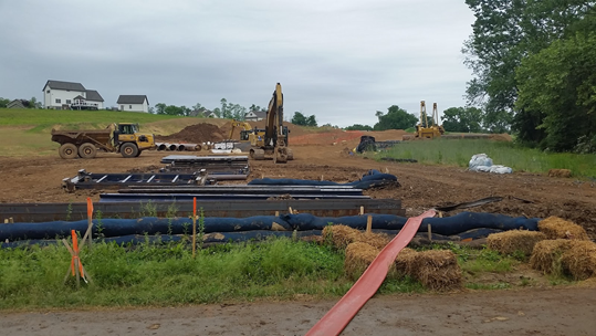
The Atlantic Sunrise, a pipeline project of Sunoco Logistics, crossing Swatara Road near residential properties in Lebanon, PA.
Mount Gretna, PA -- The Sierra Club Pennsylvania Chapter and Lebanon Pipeline Awareness recently teamed up with FracTracker Alliance to try out their new mobile app created to track oil and gas activities in real-time, and to visit a community caught in the crosshairs of the fossil fuel industry.
The FracTracker app is a free, digital tool designed for concerned residents, organizations and researchers to document industry impacts on communities and the environment, map oil and gas infrastructure, and communicate the associated risks. App users submit geolocated reports, classified by sensory impacts, to the app’s activity feed. As public awareness about oil and gas infrastructure is lacking, the idea here is to build a body of data and photographic evidence.
That’s good news for Lebanon Pipeline Awareness, a grassroots volunteer organization on a mission to raise awareness about fracking and pipeline activities, and to protect their home, Lebanon County, PA. With the hydraulic fracturing fields of the Marcellus Shale to the north and the refineries and export facilities on the East and Gulf Coasts, Lebanon County is caught directly in the middle. At present, this area of south central Pennsylvania is facing the construction of two major pipelines, Atlantic Sunrise and Mariner East 1, projects of Sunoco Logistics.
Armed only with their smartphone cameras and the FracTracker app, members of each organization traveled to a number of frontline communities along both pipelines to monitor active construction zones. Though several of the participants live in Lebanon and knew the extent of the projects, a few others, including myself, had never witnessed oil and gas infrastructure in person.
The first stop on the tour was to a rural residence on Fort Swatara Road adjacent to Fort Indiantown Gap land. The homeowner, who operated a dog kennel out of their home, said that the land has been in their family for decades, and behind their house it used to be covered with a grove of beautiful persimmon trees. Now they are all gone, except two. When the Atlantic Sunrise came through, they cleared a right-of-way through the grove, creating the work zone only 45 feet of the homeowner’s bedroom.
Participants used the FracTracker app to report photos of the pipeline and note the presence sensory conditions.
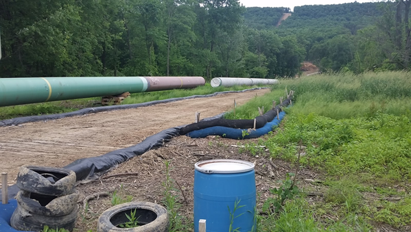
The Atlantic Sunrise clears a forested habitat and wetland only 45 feet (on the right) from a nearby residence near Fort Indiantown Gap.
At another location, the same pipeline bisected a soybean farm and left a large open borehole filled with water marked off by orange netting. Though no trees had been cut down in this section, the impact to the nearby farm was still evident. From the road crossing, one could see erosion and sedimentation occurring on the pipeline construction site in close proximity to crop fields and farm buildings. It makes one wonder, “Does this have any effect on the crops”?
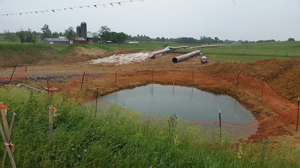
A borehole full of water being constructed under Ono Road on agricultural land.
Though the pipeline will ultimately be hidden underground, the risk of contamination to groundwater and well water is still present and should not be overlooked. With this in mind, the last stop on the tour was to a crossing on Swatara Drive to see a conventional boring under the Swatara Creek. While each site visited so far had some cause for concern, this site, which was encroaching on a local waterway, stirred up many emotions and stronger reactions from pipeline monitors.
Known locally as the “Swattie”, Swatara Creek is a tributary of the Susquehanna River, which eventually flows into the Chesapeake Bay. Given that the creek provides drinking water for residents in the Swatara Creek Watershed and has a designated 42-mile Water Trail from Johnstown, Lebanon County to Middletown, Dauphin County, it’s no wonder that a pipeline boring under it is upsetting and something to keep a close eye on.
Monitors submitted several reports at this location from varying angles to document the impact to the creek. It’s was not a pretty sight.
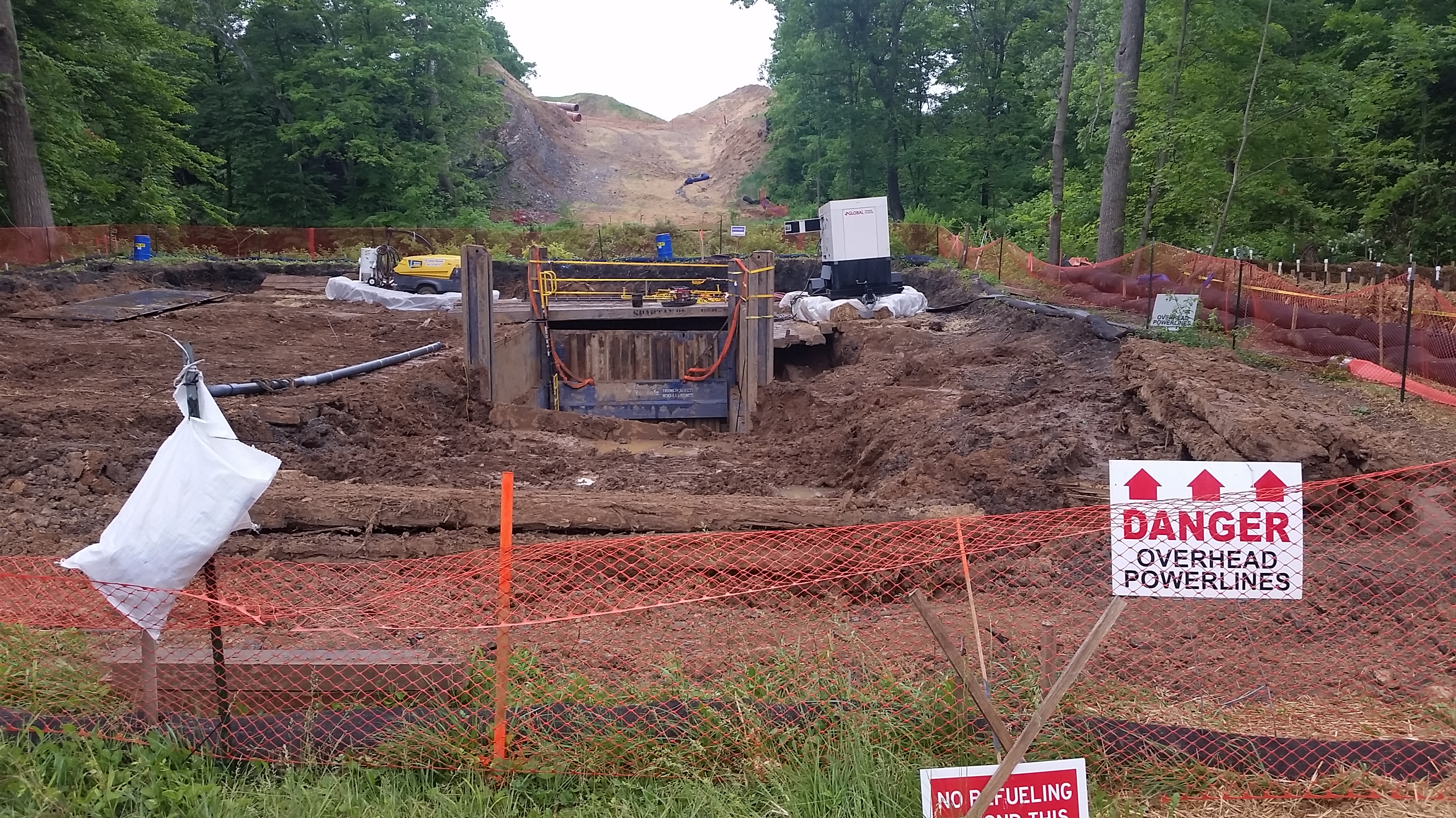
Drilling under Swatara Creek.
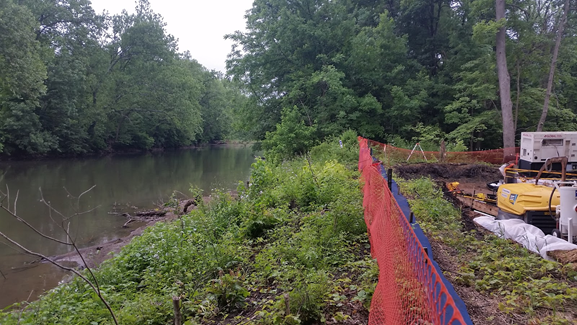
Taken from the top of the stream bank, looking upstream at Swatara Creek.
After returning from the final site, pipeline monitors examined the app’s map feature and scrolled through the activity feed to see what others had observed. Of all that the group had witnessed on their trip, having the geotagged, photographic evidence to show how close these pipeline projects come to residential communities was significant. As these fracking activities directly affect their towns and farmland, organizations like Lebanon Pipeline Awareness know what is at stake and that this data is key in their fight.
Since knowledge is power, the FracTracker app is helping to inspire individuals and groups across the nation to learn what is happening in their communities and create more awareness about the impact of fracking and pipelines.
If you are feeling motivated to take action, you too can be a pipeline monitor and report the oil and gas activities occurring where you are. To participate, visit Google Play or the App Store and download the FracTracker app.
Rachel Rosenfeld is a Community Outreach Coordinator with a focus on water issues and volunteer support in Bethlehem, PA. If you would like to learn more or get involved, please contact Rachel at rachel.rosenfeld@sierraclub.org. (All photos were taken by Rachel Rosenfeld)