Under Our Feet
In celebration of August as National Water Quality Month last month, GEAA launched Under Our Feet, a new interactive website designed to promote better understanding and protection of the Edwards and Trinity aquifers and, especially, the Edwards Aquifer Recharge Zone that supplies the water for over 1.5 million Texans.
Realizing that very few people understand what a marvelous resource we have in our uniquely prolific karst aquifer, GEAA designed this site to encourage everyone to love this mysterious underground landscape as much as we do. “Under Our Feet” provides users with an engaging overview of the Edwards and Trinity aquifers, karst groundwater systems, the Edwards watershed landscape, risks facing the aquifer systems, how to protect karst aquifers, and how to stay involved.
Users will discover which zone of the Edwards Aquifer they live in, what that means in the groundwater cycle, what risks the aquifer is facing, and what actions they can take to protect the Edwards Aquifer. The site uses interactive maps, links, infographics, and photos to provide an engaging experience for all users and can be accessed on cellphones, tablets, laptops, and monitors.
Adults will be encouraged to Take the Pledge to adopt habits and practices that will protect the Edwards spring fed streams and keep our water supply healthy. Children can get their feet wet in aquifer protection and Adopt a Blind Salamander, one of the endangered species that lives under our feet and nowhere else. Visit Under Our Feet today!
by Rachel Hanes, Greater Edwards Aquifer AllianceCeramic Artist Diana Kersey: Outdoor Nature Installations, and Ollas for Irrigation
Our September General Meeting features Diana Kersey, accomplished San Antonio ceramicist, who will tell us about her art installations and the beautiful ollas she has created.
Tuesday, September 17th
6:00 pm
Meeting schedule
| Informal get-to-know-you | 6:00 pm to 6:15 pm |
| Announcements | 6:15 pm to 6:30 pm |
| Featured program | 6:30 pm to 8:00 pm |
Venue
This is an in-person meeting at:
William R. Sinkin Eco Centro, 1802 North Main Avenue
Map
Program topic
Diana will share a slide presentation of some of her work exhibited in here in San Antonio in indoor and outdoor spaces. All have an environmental theme, illustrating the lives of organisms found in our south Texas region. You may have seen one of her works, the ceramics mounted on the Mulberry St. bridge in Brackenridge Park showing the life cycle of the Texas Bull Frog in beautiful turquoise, blue, and green ceramic oval tiles.
Diana will also show us the unique ollas she has created, how she conceives and crafts them, and provide examples of how they have been used here in San Antonio (e.g. Beacon Hill Community Garden). Ollas (unglazed clay pots) are an old yet efficient irrigation technology especially important in times of drought. The pots, partially buried in the soil and filled with water, provide a slow, consistent moisture supply to adjacent plants simply by osmosis and capillary action, without wasteful evaporation, percolation, or runoff. The soil surface remains dry, discouraging seedling weed growth. With addition of a cap, evaporative loss and mosquito growth are minimized.
For more information:
- An interview with the speaker: San Antonio's Diana Kersey: A Life Molded Into Works Of Art
- The speaker discusses her ollas: Ancient Irrigation with Diana Kersey
- More on ollas: The Ancient Science of Ollas, Ollas: Water Your Garden the Ancient Way
About our speaker
Diana Kersey is a visual artist working exclusively in clay, from small studio pieces to large indoor and outdoor architectural installations. Her work reconnects us with the earth, as a response to the barrier our urban environment creates between ourselves and nature, a barrier that makes climate change and environmental destruction easier to ignore. Her sculpted images of birds, insects, fish, and flowers suggest a shared primordial narrative, in a style instantly identifiable with its muscular, spontaneous qualities of the material enhanced with colorful, translucent glazes. Her public works have been commissioned by the City of San Antonio (e.g. San Pedro Creek Culture Park), VIA Metropolitan Transit, The San Antonio River Authority, the City of Harlingen, and private individuals; you have likely seen her work in various places around San Antonio on walls and as freestanding sculptures.
Diana grew up in Lubbock, Texas, and as a child became entranced by working with clay. She earned an MFA in ceramics from Washington State University (1997), and a BFA in drawing from Texas Tech University (1994). In 2022, she was awarded the Lynn Ford Craftsman Award (San Antonio Conservation Society), The Artisan Award (Texas Society of Architects, and the John Staub Award (Institute of Classical Architecture and Art, Texas Chapter). In 2023 she was presented with an Arts & Letters Award for Artistic Merit (Friends of the San Antonio Public Library) and named Best and Brightest (University Roundtable). This year, Diana is serving as 2024 Texas State Artist in 3D (Texas Commission on the Arts). A faculty member of Northwest Vista College, she owns and operates Kersey Ceramics LLC.
For more information and pictures of her artwork in San Antonio, visit the speaker’s website. (Source: Adapted from the speaker’s website.)
The Alamo Group of the Sierra Club holds its general meetings the 3rd Tuesday of most months. They're always free and open to the public.
Beartooth Mountains & Scenic Byways in Wyoming
The pictures below are near or along Beartooth Scenic Byway, which is 38 miles of US 212 east from the Yellowstone National Park northeast entrance on the northern Wyoming state line. In Shoshone National Forest. Another good page is at Wikipedia. Here's a PDF map from the park's map page. The byway traverses the Beartooth Mountains, going northeast through bit of Montana and then back into Wyoming, then past where the pictures below were taken, and back into Montana again.
Here's the Wikipedia article on the Beartooth Mountains. Says this mountain range was initially named after Beartooth Butte (pictures 1, 3) then later after Beartooth Peak (see the 4th pic caption). In that linked article there is a picture including Beartooth Peak, and another of Granite Peak, at 12,807' the highest elevation. The latter picture appears as the area is described, "an inverted mountain range", further below.
Was wondering years later, did I really climb Beartooth Butte? It looks more difficult than I remember. Using picture location data I created a waypoint in my Garmin Basecamp PC app. Yep, really was taken from the summit, I wasn't imagining that.
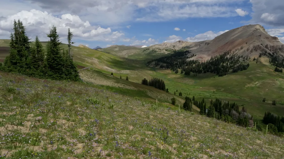
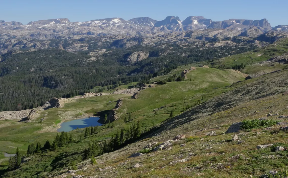
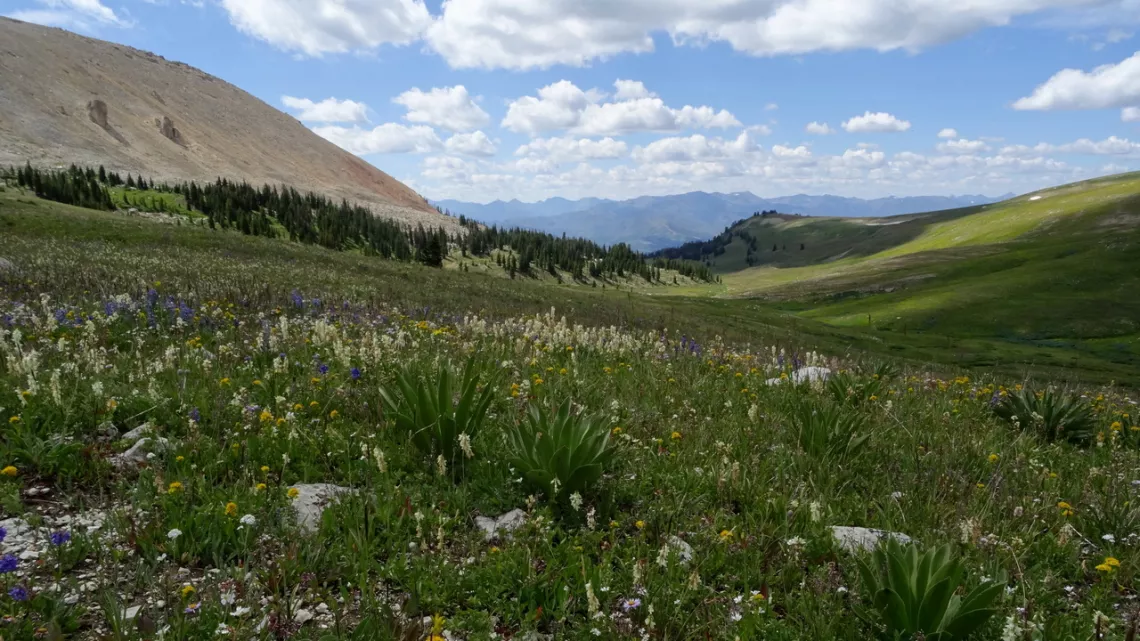
Looking for nice hikes in this area found an article: Beartooth Plateau High Route. Subtitled 3 Boys, 300 Lakes, and 3,000,000 Boulders. Likely more challenging than whatever any of us old characters would try but the story and pictures are great. A map and route details aren't provided but this seems to have been north from the scenic byway west of Beartooth Butte. Description of the terrain: "The Beartooth Plateau is, in many ways, an inverted mountain range. The low mountains are incredibly steep, vertical walled canyons. But the peaks are massive flat plateaus." In the 3rd, 4th pictures we can see some of this.
Looking further found another hike on HikingWalking.com about Beartooth Lakes Loop, 7.8 miles, elevation gain 1010', max elevation 9920'. Inviting pictures! Just east of my Beartooth Butte route, I missed out. At FreeRoamingHiker.com there is the Beartooth Loop. This is 10.9 mi, max elevation diff 1,530'. Both of these look easier than the High Route mentioned above.
On HikingProject.com with a search for "Beartooth" we can find these hikes with maps and downloadable GPX files so we could actually (hopefully) do these safely. On this website the routes are visible as intersecting multiple trails but no problem, just download the various GPX files. Looking at these resources I couldn't find my route wasn't shown but it was fairly obvious, though not a real trail at spots.
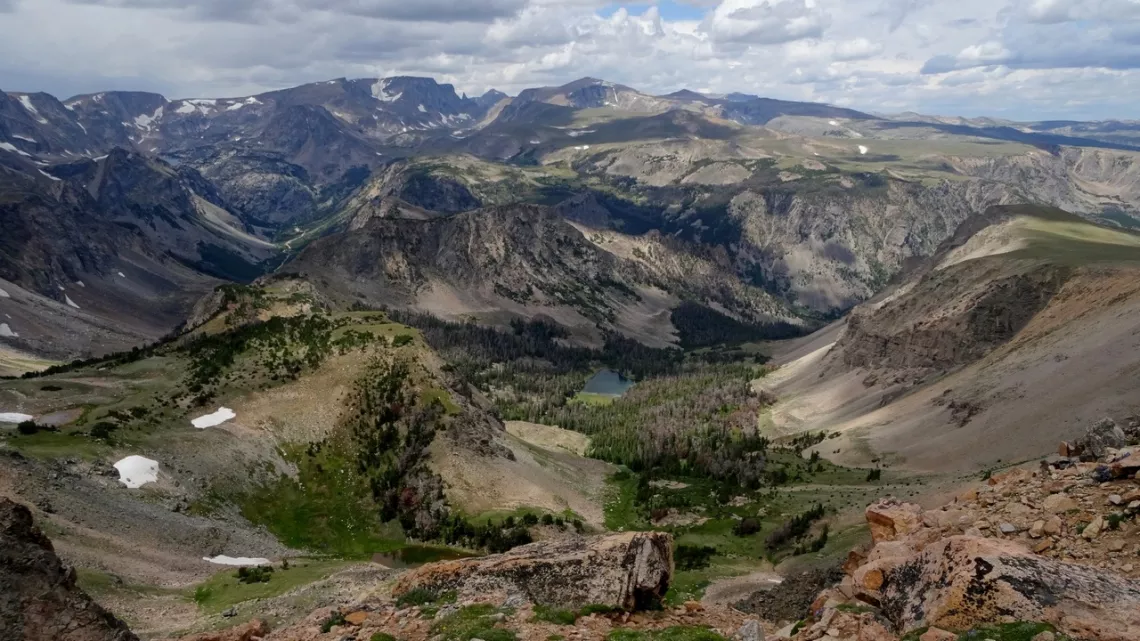
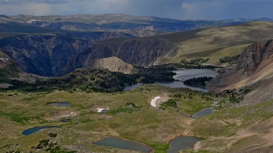
Visiting the Beartooth Plateau
Possible in summer as the snow and ice hang around due to the altitude; Beartooth Pass is 10,947'. The scenic highway is closed likely mid-October through mid-May. May could be good for young folks thinking about cross-country skiing and snowshoeing. The wildflowers were great in mid-July. We could look at average temps for Cooke City Montana, on the scenic byway just east of the park entrance, though that is 2500' lower than Beartooth Pass.
Found this very good resource at MontanaHikes.com searching for "camping Beartooth highway". A list of 21 campgrounds with links for each! As that page says most of the scenic highway is in Montana but a middle section is in Wyoming.
Thinking about returning myself. Rather not drive though Yellowstone both coming/going. We can use hwy 296 which runs between the southern section of Beartooth Scenic Byway southeast to hwy 120 which goes southeast to Cody. Reading the Wikipedia page about hwy 296, that is Chief Joseph Scenic Byway. Seemed familiar; oh yeah I did that on the way there in 2015, then drove through Yellowstone to Glacier National Park. Also very scenic indeed.
A bit about wolves in Yellowstone National Park
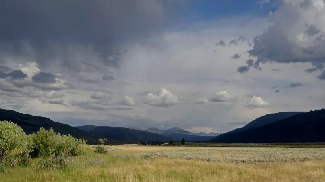
Fifty miles west of Beartooth Pass is the Yellowstone National Park entrance. Driving west into the park we are in the Lamar River Valley, where wolves were first re-introduced in the park. Below is a picture; with another picture of the valley and wolf info, article in the December 2018 issue of this newsletter. Other pictures and park bits January 2019.
In a Wikipedia article about the re-introduction of wolves in this valley, 1995, there is a section on the ecological impact of this. Wolves are a keystone species; also a CaliforniaWolfCenter.org article. The wolves ate some elk (surplus due to the wolves's absence) and pushed them away from a few waterways, allowing the recovery of aspen, which provide sustenance and building material for beavers.
Beaver are themselves a keystone species and ecological engineers; with their recovery wetlands were restored and then fish, amphibians, reptiles, insects and birds also recovered. The balance of nature was a little bit restored, hooray! In January 2024 there was an article about a great book, Beaver Land - How One Weird Rodent Made America by Leila Philip.
From the e-Mailbag
From time-to-time, the Alamo Group receives messages concerning local environmental issues. If you have thoughts on any of these issues, send us a message and we'll forward it to the writer. The views and opinions expressed here are those of the individual authors and do not represent the views or opinions of the Alamo Group or its members.
We’ve discovered the world’s trees absorb methane
Many of you may have already read this article: We’ve discovered the world’s trees absorb methane – so forests are even more important in the climate fight than we thought. Or you may already be aware of this information, but I hope that you (we) would take time to examine the issue, and protect the environment for the future generations that we care about.
submitted by Steve A.
Outings: The Call of the Wild
Visit the Alamo Sierra Club Outings page on Meetup for detailed information about all of our upcoming Sierra Club Outings.
The Alamo Sierran Newsletter
Richard Alles, Editor
Published by the Alamo Group of the Sierra Club, P.O. Box 6443, San Antonio, TX 78209, AlamoSierraClub.org.
The Alamo Group is one of 13 regional groups within the Lone Star Chapter of the Sierra Club.
Changed your contact information?
If you're not sure whether the Sierra Club has your current email address, send an email to Member Services with your name and address and/or member ID (see Locating Your Member ID) so they can add your email address to your member record.
Have you moved? Let us know by sending your old address, your new address and your member ID to: address.changes@sierraclub.org.
Go online for the latest news and events
 |