Camp Bullis Environmental Protection Advances
The Sentinel Landscapes Partnership was established in 2013 by U.S. Department of Agriculture (USDA), Department of Defense (DOD), and the Department of the Interior (DOI) to strengthen military readiness, conserve natural resources, bolster agricultural and forestry economies, increase public access to outdoor recreation, and enhance resilience to climate change around military installations and ranges. In 2024, the Partnership was updated to include FEMA as a signatory.
In April 2020, the Alamo Area Council of Governments (AACOG) led a coordinated effort to apply to the federal Sentinel Landscapes Partnership program to have the area around Camp Bullis designated as a Sentinel Landscape. In February 2022, the Camp Bullis Sentinel Landscape was officially recognized one of ten nationwide and the first in Texas. Using watershed boundaries, the total designated area is 949,744 acres. The more than 50 local government, regional agency, state agency and non-profit partners voted for the Hill Country Alliance to take the lead in July 2021.
Initial successes of the Camp Bullis Sentinel Landscape (CBSL) Partnership between 2022 – 2024 included:
- $8.57 million from the USDA for land stewardship and conservation;
- $5.1 million from the Department of Defense for land stewardship and conservation with up to $5 million match from the City of San Antonio Edwards Aquifer Protection Program;
- $723,000 from the National Fish & Wildlife Foundation for creating a geospatial planning tool and conducting a groundwater study across the CBSL multi-county project area; and
- Resolutions from the Texas legislature (H.R. No. A332 and S.R. No. A247) recognizing the importance of CBSL to the state’s economy, military preparedness, natural resources, and agricultural productivity.
Alamo Group Holiday Party & Pot Luck
Dear Sierran,
Come and celebrate the joys of the season with the Alamo Group of the Sierra Club!
When
Tuesday, December 10th
6 - 9 pm
Where
At the home of Alan Montemayor:
152 Bluet Lane
San Antonio, TX 78213
Map to party
RSVP
to Alan at alan.montemayor@sbcglobal.net.
What to Bring
This will be an “indoor/outdoor” party. Our hosts will provide paper plates, cups, napkins and eating utensils, and coolers with ice.
So please bring:
- A folding chair (or two) if you have one.
- Your favorite appetizer or “side” dish to share, and serving “tool” if needed.
- We ask please NO desserts.
- Bring Your Own Beverages.
- Dress appropriately for the weather, as well as the season!
- NOTE: Please do NOT bring any single-use plastic items. Any plastic you do bring, you will be asked to take back with you when you leave.
We look forward to having you join us!
The Alamo Group of the Sierra Club holds its general meetings the 3rd Tuesday of most months. They're always free and open to the public.
The northern end of the AT - Baxter Peak in Maine, and Baxter State Park
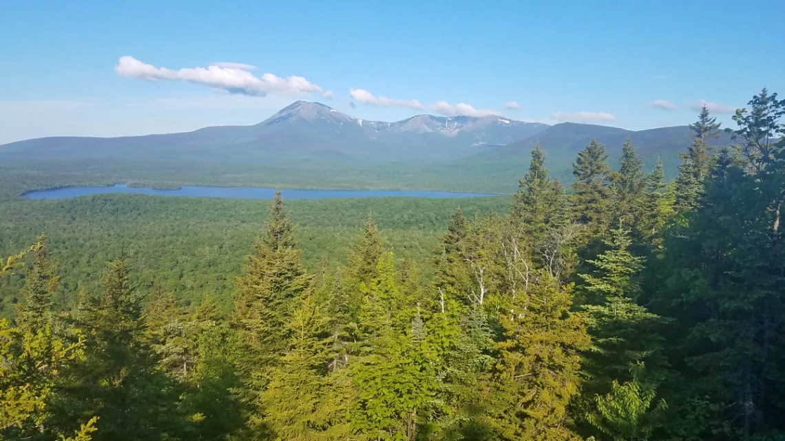
The northern terminus of the Appalachian Trail is the summit of Baxter Peak in Maine's Baxter State Park. Baxter Peak is the highest summit in Maine and one of four on Mt. Katahdin. This is a bit north-northeast of central Maine. All the pictures below were taken July 2024.
This peak is a popular destination due to the amazing scenery and because of folks getting to do this final bit of the AT. A small fraction of the hikers I saw on a day hike in July 2024 were likely actually doing the AT. The last section of this article is about climbing Baxter Peak.
Visiting Baxter State Park
Here is the park website and a good map PDF at UntamedMainer.com showing campgrounds and trails. Best to get campsite reservations though there are a bunch of sites at Seboeis Public Lands (brochure and map PDF) just SW of the state park. I didn't have a reservation but got a lean-to site at Katahdin Stream campground and slept in my car. The picture below is of Katahdin Stream immediately below my site. These sites were all built very close to the stream. No potable water is provided at the park but the creek water is fine if we have a filter/sanitizer.
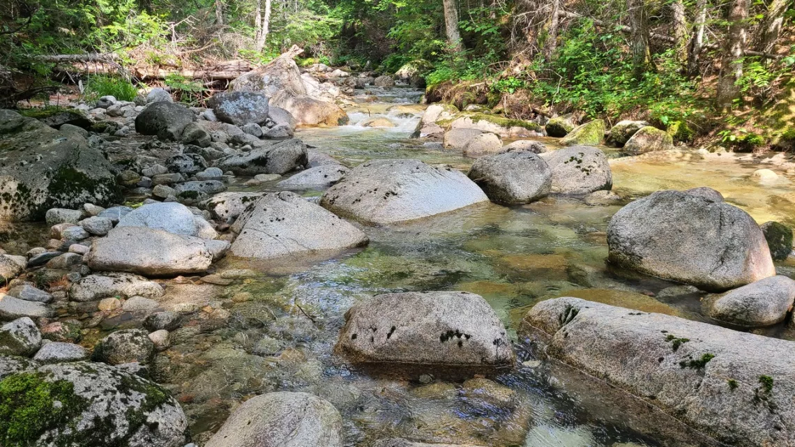
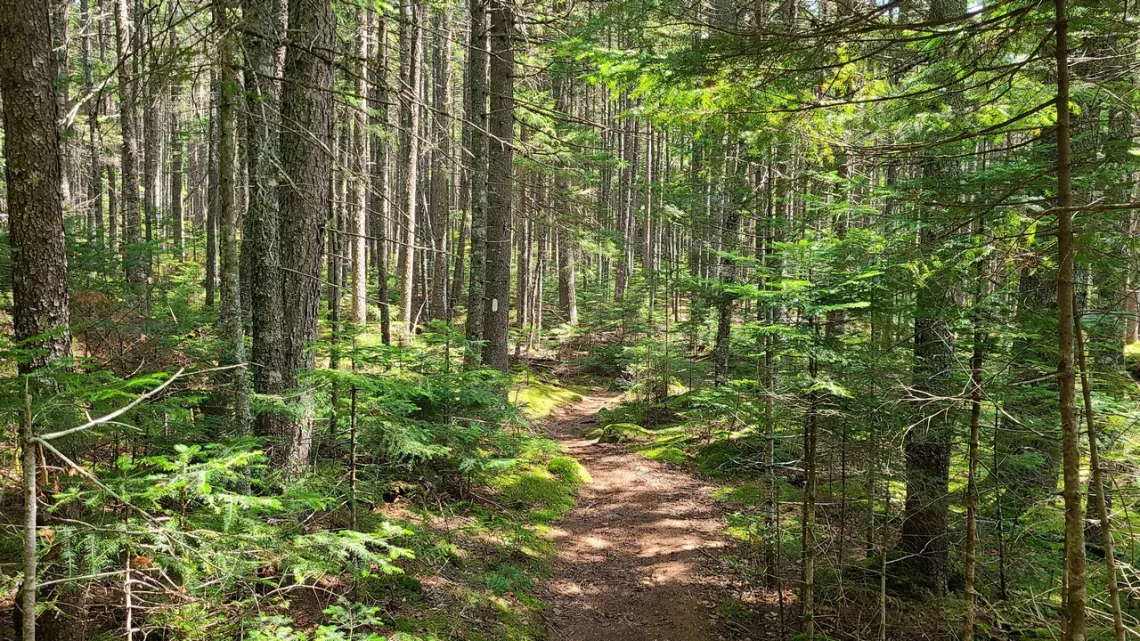
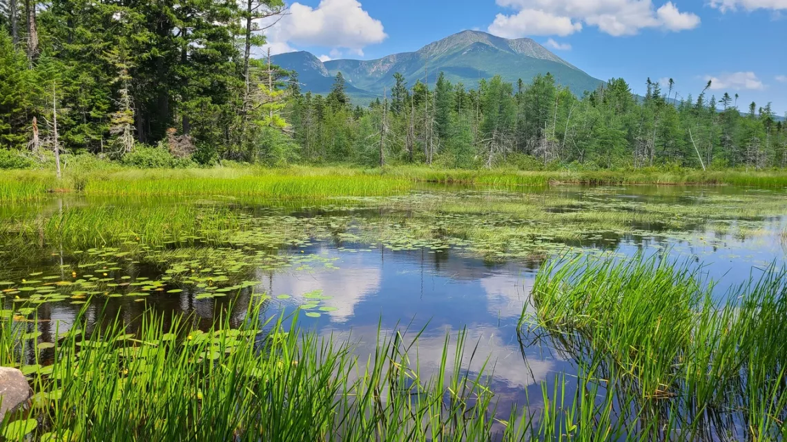
One super hike is SW from the campground along the AT, crossing Park Tote Road and going around a few lakes including Daicey Pond and Grassy Pond (second picture below). This was 6 mi total with only 140' elevation difference. The route can be seen on the map linked above if we look carefully. The next picture is from the AT on this route. Looking at these vistas I found great enjoyment thinking about the range of plant, animal and microbe species present that I couldn't see more than a fraction of. And realizing I understood a tiny fraction of what I saw.
Doing Baxter Peak
There are four routes: the Hunt, Abol, Knife Edge, and Cathedral trails. Hunt is the last bit of the AT, 5.2 miles each way from Katahdin Stream campground, SW of the peak. Abol comes up from the SE from Abol campground. Knife Edge climbs from Chimney Pond, north below the peak and loops E and then W across a challenging ridge and a summit of rough rock. Cathedral climbs W from Chimney Pond then across Hamlin Peak and then S to Baxter. In the October 2016 issue of this newsletter there was an article about doing the Knife Edge and Cathedral loop from Chimney Pond campground across Baxter and other bits about the park. See the 7th picture with a view of Chimney Pond.
I did Hunt Trail up Baxter and a little loop to the west coming back to Hunt. My track from the campground was 10.3 mi round trip, altitude gain 4,228', max altitude 5,200'. Took me 11 hrs 20 mins with only limited breaks! My legs were stiff and sore for 4 days, maybe mostly due to my age.
Hunt is said to be one of the toughest bits of the AT (I think likely the very toughest). Here's a list of six such. I haven't done many of the others except a bit in Bigelow Preserve, Maine (September 2017) and another in the White Mountains, New Hampshire (February 2018).
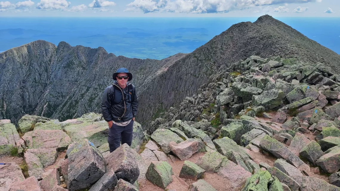
The challenge with Hunt is not just the up/down but the serious sections climbing over big granite rocks, second picture below of a moderate bit. The upper 2/3 of the route has a lot of these sections. There was one spot above the tree line where realized I was hanging backwards with two good hand holds ready to step down, but the foot holds below were a good ways down, then realized I must figure out where my next hand holds would be. In many spots we imagine surely there is an easier way left or right, might be but no telling how far we have to scramble, and then find more unforeseen challenges. The route would be impossible with ice, difficult with rain though the granite has mostly great footing even when damp if we are careful.
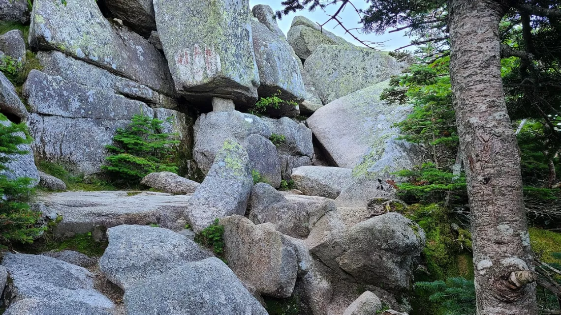
People attempting the entire AT would best do Baxter as a day hike from Katahdin Stream campground. Carrying a backpack up/down Baxter would make it nutso more difficult.
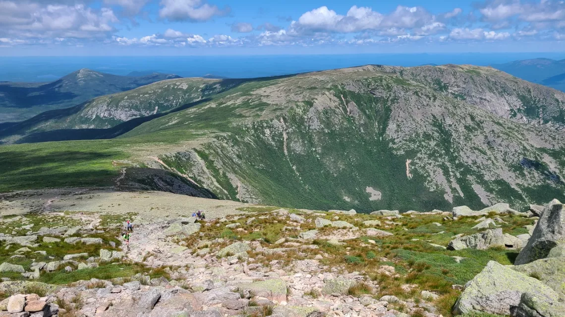
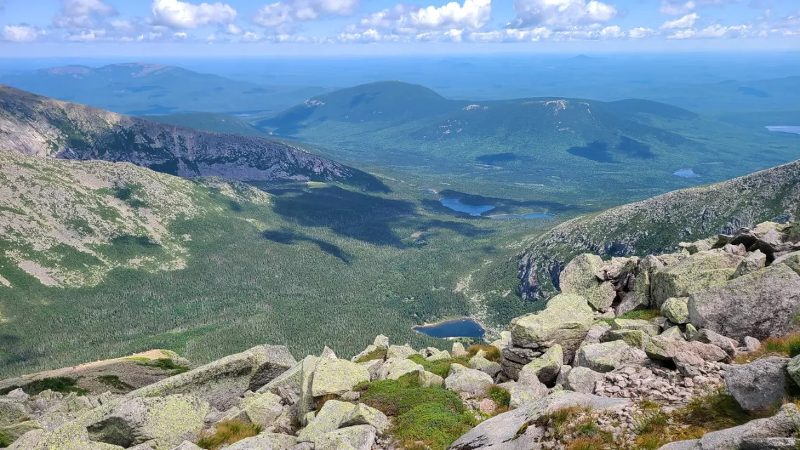
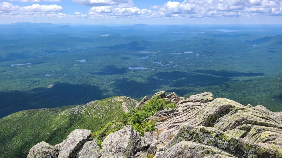
The final picture below is from Mt. Barnard in Katahdin Woods and Waters national monument just east of Baxter State Park. KAWW was also discussed in the October 2016 article linked above.
Barnard is the western terminus of the International Appalachian Trail/Sentier International des Appalaches (IAT/SIA). Saw a bunch of IAT/SIA trail signs on the easy hike up Barnard. To be covered in a future article. Being ignorant about the IAT/SIA some research provided a pile of interesting info.

Outings: The Call of the Wild
Visit the Alamo Sierra Club Outings page on Meetup for detailed information about all of our upcoming Sierra Club Outings.
The Alamo Sierran Newsletter
Richard Alles, Editor
Published by the Alamo Group of the Sierra Club, P.O. Box 6443, San Antonio, TX 78209, Website.
The Alamo Group is one of 13 regional groups within the Lone Star Chapter of the Sierra Club.
Changed your contact information?
If you're not sure whether the Sierra Club has your current email address, send an email to Member Services with your name and address and/or member ID (see Locating Your Member ID) so they can add your email address to your member record.
Have you moved? Let us know by sending your old address, your new address and your member ID to: address.changes@sierraclub.org.
Go online for the latest news and events
 |