Comb Ridge in Bears Ears National Monument and a Book Review on Seasons – Desert Sketches by Meloy
Firstly, geology stuff
A major feature in Bears Ears is Comb Ridge, an 80 mile long monocline with lots of hikes to Ancestral Puebloan ruins and petroglyph displays. Here's a Utah.Geology.gov page. Oh yeah there is Waterpocket Fold (NPS page) in Capitol Reef National Monument, 100 miles long, another monocline facing the same direction, 80 miles northwest of Comb Ridge. These web pages mention the monoclines resulted from the laramide orogeny. Some pictures of Waterpocket Fold in the August 2016 issue of this newsletter.
The laramide orogeny, what's that? The Wikipedia page explains this was the event 50-70 million years ago that created some of the features in the western US including the Rocky Mountains and the basin and range province. Bit about the latter in a October 2023 article, which mentions looking at a map we can see the north-south trending little mountain ranges, parallel to the two monoclines. We can imagine tectonic plates ramming together, one forcing itself below the other, resulting in the monoclines and the basin and range topography.
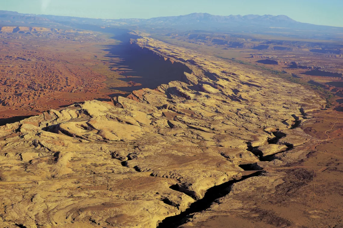
Photo credit: San Juan Record, Karen Shumway. Also used in the April 2019 issue.
Hiking stuff, particularly to the ridge summit
Driving around and hiking these monoclines may seem more appealing than the Rockies as the structure is so visible, intelligible and the hiking is mostly easier. When looking at the aerial photo above, we think surely there are reasonable routes to the top of Comb Ridge! Searching I found mention of two. Those are about visiting ruins and petroglyphs and then can get to the summit with a little further climb.
We imagine if simply choose what looks promising from the bottom we can find a way up at many spots. We get a ways up then (if we are lucky) realize oh let's go over there, safer and not as steep. Then repeat that ten times and maybe on the way down also, when it could be more dangerous, being slickrock, which is usually very good footing except when icy. Though beware accumulations of small stones (which my hiking buddies know as BBRs, ball-bearing rocks). But we might get pics from the top!
The hikes mentioned below are west from Butler Wash road, which runs south 21 miles from Utah hwy 95 to US 163. We can see the latter in the prior picture. Oh yeah here's the BLM Bears Ears map. The road pretty much is just east of the wash itself except at the north and south ends where it is further east.
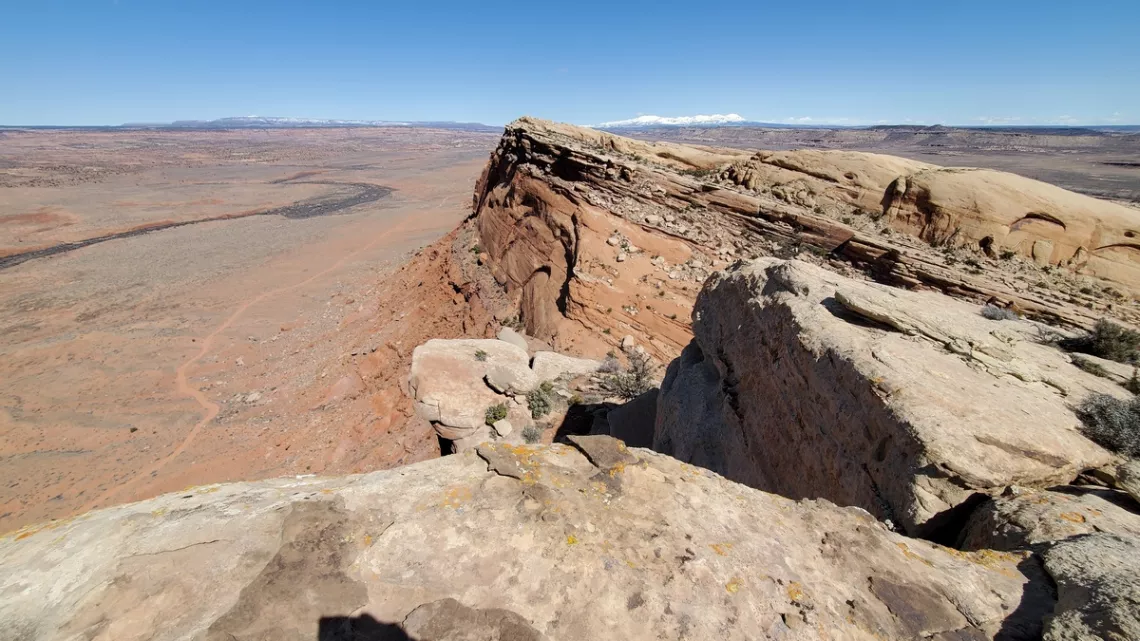
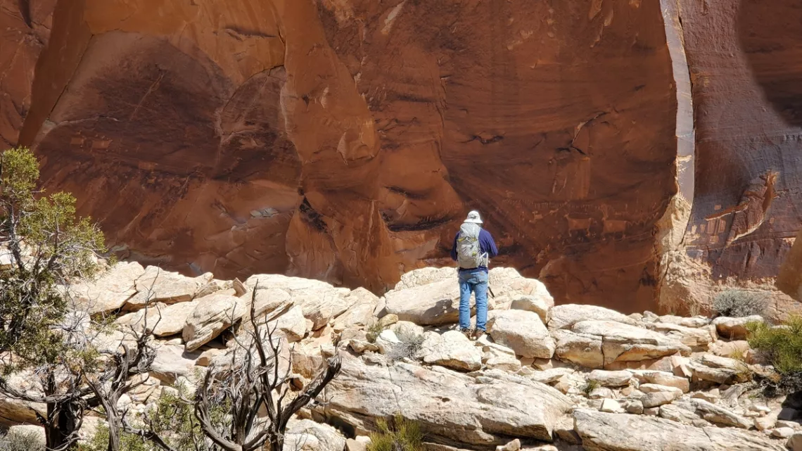
Looking south from the top of Comb Ridge above Procession Panel. Comb Wash road is below. Valley of the Gods, another area in Bears Ears is upper right; one picture there in March 2017.
Finally, hikes!
It is very useful to review some web pages about what can be seen along Comb Ridge, hiking up from Butler Wash. We read one and think we understand, then another and know some more, etc. Here's one at AmericanSouthwest.net with a map with some of the favorite hikes noted though not Procession Panel, but Split Level/Ridge Top ruins, Monarch Cave and Wolfman Panel mentioned below are. Another at RoadTripRyan.com about Split Level/Ridge Top, have to create an account but that's free and the specifics are excellent, and many hikes all around the larger area are well documented.
About these hiking routes. There are no signs. Best we download the GPX files to phone apps. In particular RoadTripRyan.com does a good job with these, and also mileage from the Bulter Wash road turnoff from hwy 95. Then we can understand where the parking and start of the routes are. The parking is mostly obvious at the popular routes and the route may be also, with some cairns. But best we pay close attention.
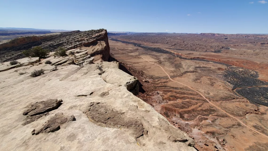
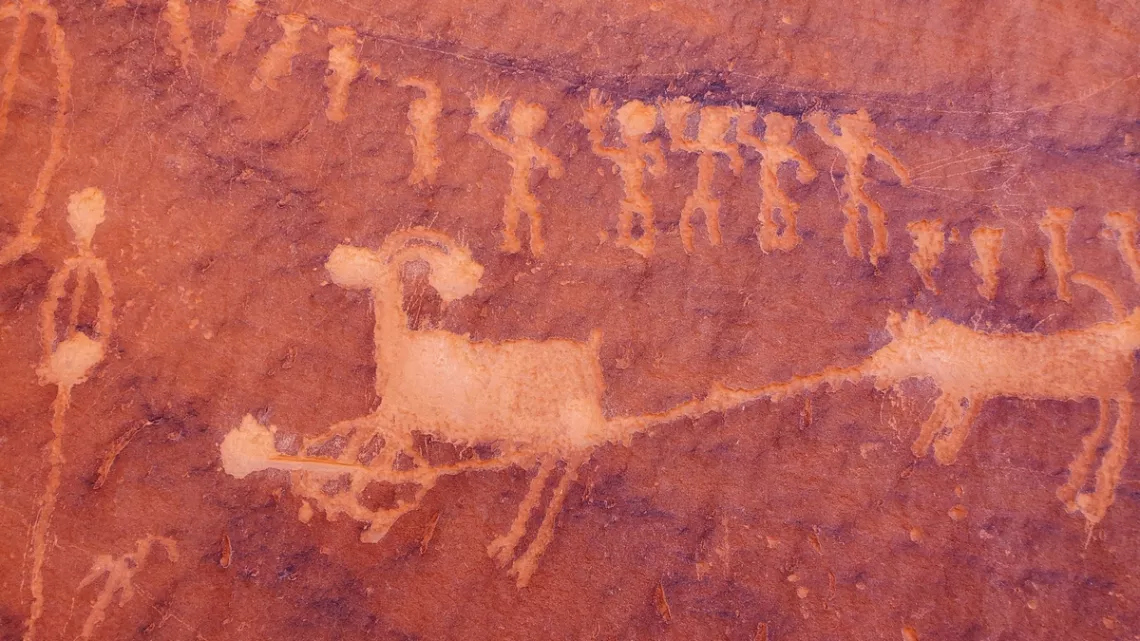
Procession Panel, with a little further hike to the summit of Comb Ridge
The next two pictures are at this panel. There is an article at HikingWalking.com; it is 2.8 mi RT, 510' gain to the panel, with the parking spot 14.8 miles south from hwy 95. Good pic on that page with button at lower right for viewing a bunch of additional pictures of the route. The page says “Without a doubt, my favorite rock art site along the Lower Butler Wash Road is the amazing Procession Panel, a 15-ft long petroglyph panel though to represent a ceremonial gathering or migration story."
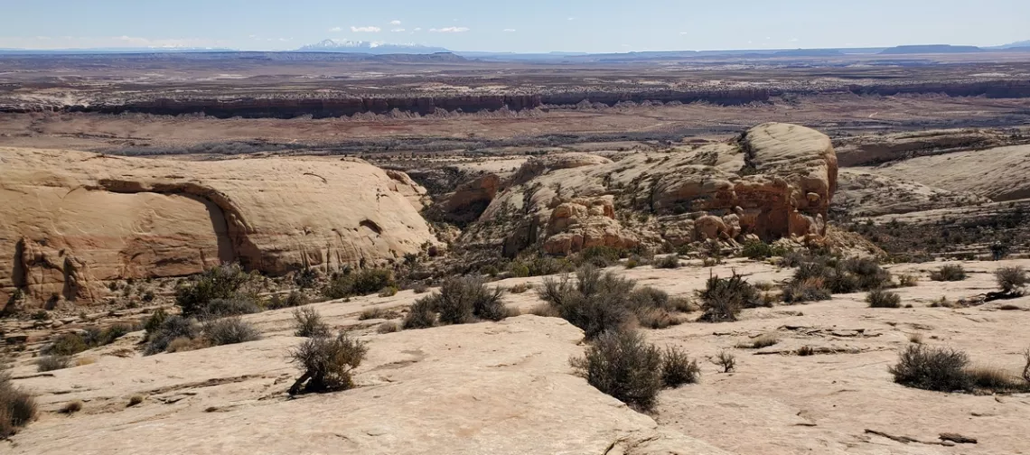
Other bits
Monarch Cave is one of the most popular hikes. There were details and a picture in April 2019. I remember an apparent cut to the north off the route to the ruins, some people might have used that attempting to access the summit. Wonder if they succeeded; didn't find mention of that. The parking spot for Monarch is 0.6 miles north of that for Procession Panel.
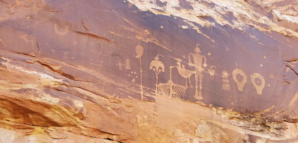
Wolfman Panel, the last picture. A short drive from US 163 with a turnoff to parking less than a mile north. There is RoadTripRyan.com's page, and another at HikingWalking.com; both mention the bullet hole pockmarks visible in the picture. What was someone thinking of when deciding to do this desecration? We can only imagine. If we wish there are some ruins across the wash just north and south of the panel.
In the July 2023 issue there is a picture of the Grand Gallery pictograph panel with much worse damage, in the Horseshoe Canyon unit of Canyonlands National Park. I found a bunch of web pages talking about petroglyphs and pictographs being used for target practice. A more ignorant and insulting sort of behavior regards the ancient cultures that created these I cannot think of.
Book: Seasons – Desert Sketches by Ellen Meloy
This is a publication of essays Ellen wrote for the NPR affiliate in Salt Lake City, KUER. From the introduction:
They were funny, beautiful and almost always surprising. ...After she died in 2004 those tapes just sat there on a shelf. We realized that was a shame so we decided to share them ...Most of us came to know Ellen when the desert reclaimed her in Utah. She and her husband Mark made the tiny town of Bluff [just southeast of Bears Ears National Monument] their home.
In the really important ways, she never ever distinguished herself from all the other settlers of the West. Ellen said most people come to the desert for something else and then strip themselves of everything but water and their thoughts. At some point, she said she crossed that threshold of absence in the desert. She looked beyond the austerity and found the place packed. Maybe that's when she started writing.
From the forward (with more profound commentary by Annie Proulx):
In the end, what we take away from the essays of Ellen Meloy is her impassioned request to regard what is around us. Pay attention to the weather, to what breaks your heart, to what lifts your heart. Write it down.
Ellen wrote a number of other books about the southwest, including Raven's Exile - a Season on the Green River, mentioned in a April 2024 article.
by Kevin Hartley, Sierra Club Life MemberNature-based Agriculture
Our May General Meeting features Bryan Hummel, biologist, from the US Environmental Protection Agency.
Tuesday, May 21st
6:00 pm
Meeting schedule
| Informal get-to-know-you | 6:00 pm to 6:15 pm |
| Announcements | 6:15 pm to 6:30 pm |
| Featured program | 6:30 pm to 8:00 pm |
Venue
This meeting will not be webcast on Zoom. Attend in-person at:
William R. Sinkin Eco Centro, 1802 North Main Avenue
Map
Program topic
Nature-based principles often improve the health of our food, our water, our air, the broader ecosystem, and can convert flooding liabilities into agricultural abundance and resilient groundwater assets. This presentation will focus on “teaming with nature” to benefit People, Planet, and Profits.
About our speaker
Bryan Hummel is a native Texan and a biologist. Bryan has incorporated nature-based green-infrastructure biomimicry practices into renewable energy, watershed restoration, and habitat regeneration projects across private, state, and federal lands.
The Alamo Group of the Sierra Club holds its general meetings the 3rd Tuesday of most months. They're always free and open to the public.
From the e-Mailbag
From time-to-time, the Alamo Group receives messages concerning local environmental issues. If you have thoughts on any of these issues, send us a message and we'll forward it to the writer. The views and opinions expressed here are those of the individual authors and do not represent the views or opinions of the Alamo Group or its members.
Proposed ban on canned hunting of mountain lions
I came across this proposal, Mountain Lions - Proposed Prohibition of Canned Hunting; Trapping Standards, from the Parks & Wildlife Division in Texas . They are taking public comments until May 22 and I am wondering if the Sierra Club would be interested in taking a stand on this and emailing the membership.
They are trying to ban situations where mountain lions are trapped and then either left there to die or kept in captivity briefly and then apparently released and hunted for fun. That sounds pretty gross to me and the new law seems to be a good one if it prohibits animal abuse of that kind. I am wondering if you have seen this and have an opinion on it.
submitted by Mary T.
Outings: The Call of the Wild
Visit the Alamo Sierra Club Outings page on Meetup for detailed information about all of our upcoming Sierra Club Outings.
The Alamo Sierran Newsletter
Richard Alles, Editor
Published by the Alamo Group of the Sierra Club, P.O. Box 6443, San Antonio, TX 78209, AlamoSierraClub.org.
The Alamo Group is one of 13 regional groups within the Lone Star Chapter of the Sierra Club.
Changed your contact information?
If you're not sure whether the Sierra Club has your current email address, send an email to Member Services with your name and address and/or member ID (see Locating Your Member ID) so they can add your email address to your member record.
Have you moved? Let us know by sending your old address, your new address and your member ID to: address.changes@sierraclub.org.
Go online for the latest news and events
 |