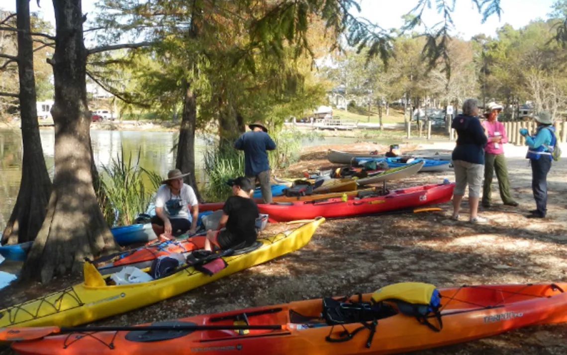
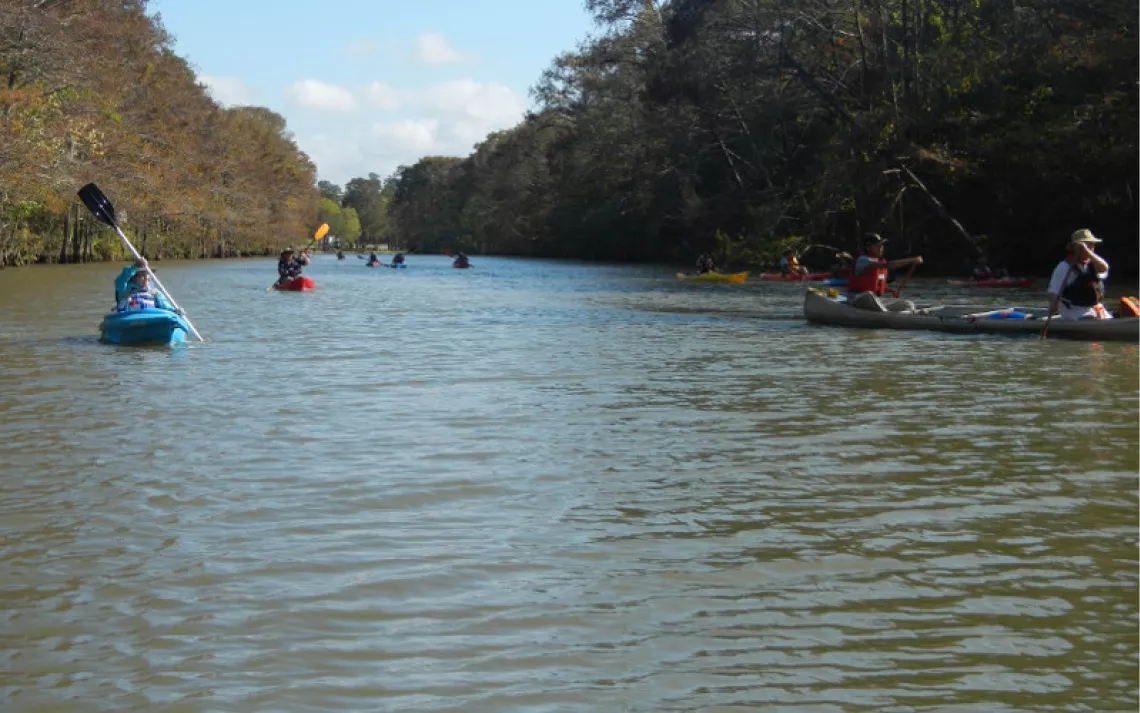
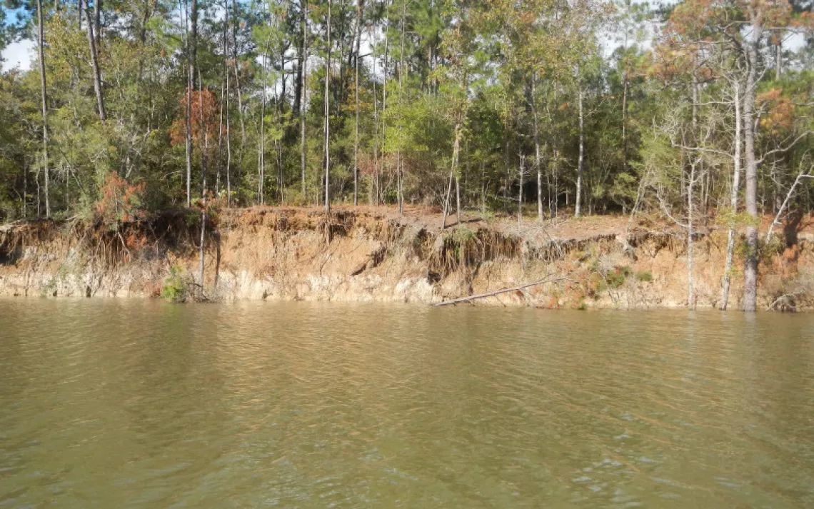
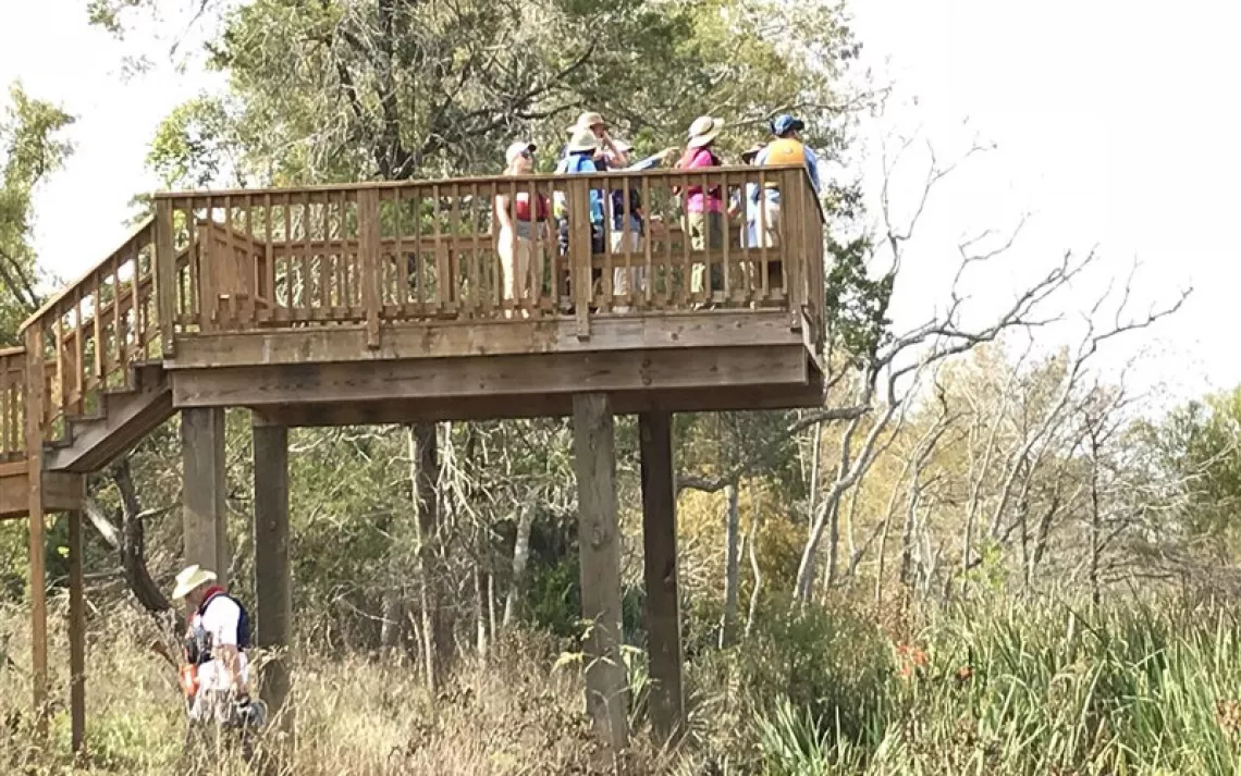
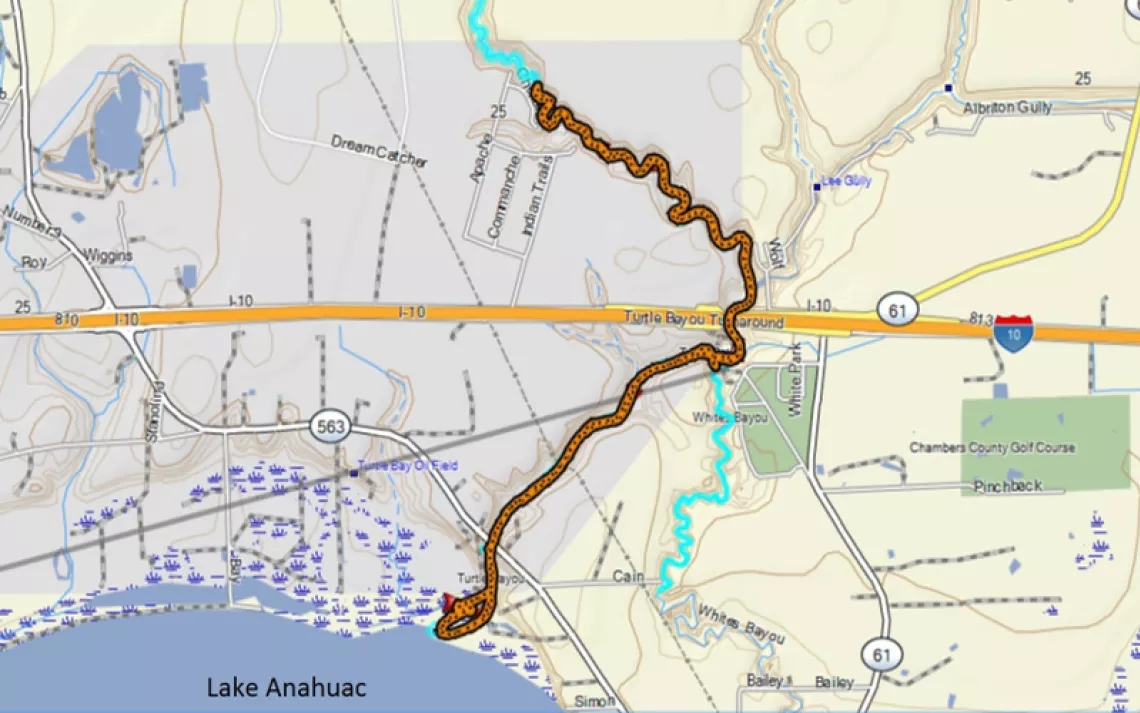
Even though our group of paddlers was large, the sign-in and other preliminaries went so smoothly that we launched our boats from White Park www.co.chambers.tx.us/default.aspx?name=parks.whites_park a few minutes ahead of schedule. Almost immediately, we began seeing signs of the high water level that had been reached during Hurricane Harvey, such as debris hanging high in trees and severe erosion of the bayou’s banks. About a mile and a quarter down Turtle Bayou we passed under Highway 563, then, a little later, landed on the bayou’s west bank. This is where some of that sediment had come to rest. It made for a nice, gently-sloping shore and landing area, but the bottom was still very soft, so that we quickly got in touch with that feeling that goes with having seriously muddy feet. A short walk took us to one of the Turtle Bayou Nature Preserve’s viewing platforms that overlook an extensive wetland complex. www.galvbay.org/uncategorized/turtle-bayou-nature-preserve/ Returning to our boats, we continued south to Lake Anahuac. The on-again-off-again wind was creating rough conditions out on the lake, reminding us of how well the forested river banks had been protecting us all during the morning.
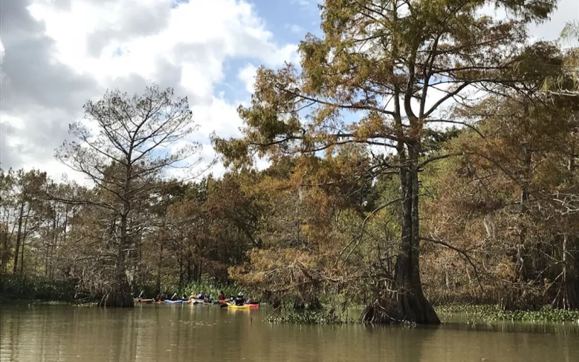
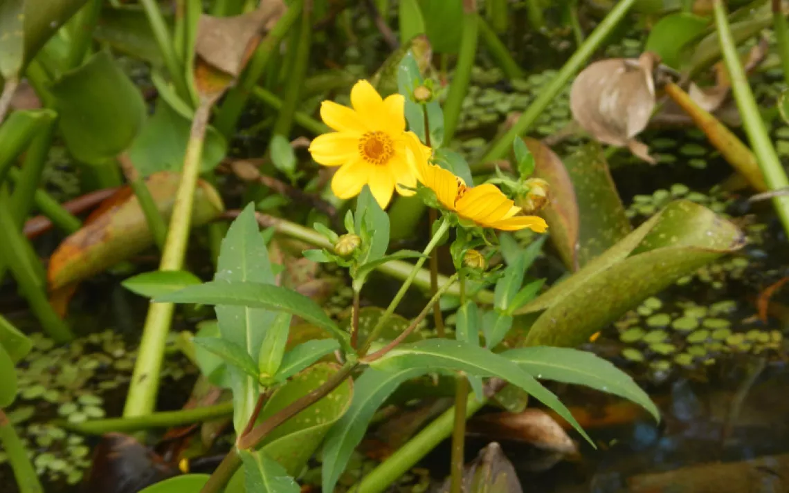
We slipped through a break in the clumps of giant cutgrass lining the west side of the bayou, taking advantage of an unusual opportunity to paddle along a small oxbow lake. Though it is usually clogged with invasive wetland plants, the small lake had been swept nearly clear of them by Harvey’s high flows. A particular attraction were the yellow blossoms of Bidens laevis, which is also known by several different common names such as “smooth beggartick.” (If you look closely at the photo of these flowers, you may also notice two different invasive species lurking in the background.) Some of the bald cypress trees were showing their autumn colors, and ranks of fallen cypress needles floated on the lake’s surface. Having paddled the small lake end-to-end, we headed back out onto Turtle Bayou and headed north. Passing back under Highway 563, we briefly traded fish stories with the two fisherman we had greeted there earlier.
Back at White Park, our group enjoyed making introductions and spirited conversation over lunch. Tom Douglas added several stories about how the area right around Turtle Bayou had played an important role during 1832-1836: both before and during the Texas Revolution against Mexico.
In the afternoon, we paddled a little over two miles north up Turtle Bayou, past Interstate 10, where the bayou’s channel becomes noticeably narrower and more winding. The water’s surface was glassy, and the rays of the low afternoon sun were reflected upward to create undulating patterns of light on the tree trunks and foliage along the bayou’s east bank. Checking the time, we turned around near where several homes have been built along the west side of Turtle Bayou, on Cherokee Circle. All too soon, our day’s adventure came to an end back at White Park.
We thanked our lucky stars for the gorgeous shirtsleeve weather we had enjoyed all day long. With a cold front moving in, we noticed that the wind had shifted progressively from the south to the northwest during the day. (Sunday would have also been a good day for this outing, although it would have been about 20 degrees cooler.)
Special thanks to Rea Inglis, who paddled our sweep boat, and to David Portz, Malcolm Le Fevre, Linda Shead, and Tom Douglas who provided photos. Albums of photos taken by David Portz and Malcolm Le Fevre can be viewed at the Houston Canoe Club’s website. www.houstoncanoeclub.org/content.aspx?page_id=187&club_id=496051#