Climate Change Is Driving Residents of Kivalina From Their Homes
For the Inupiaq town, relocating is not a matter of if but when
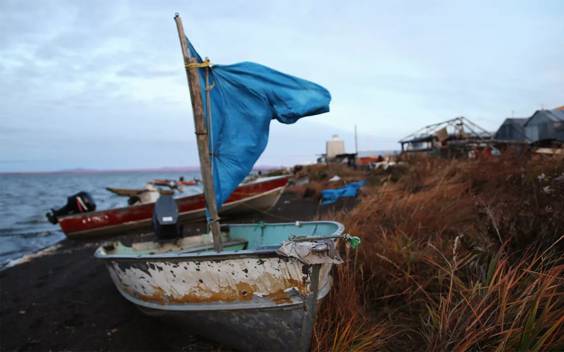
To access subsistence grounds, residents need to cross the lagoon. | Photos by Sonia Luokkala
On the night of October 18, 2004, the land surrounding Kivalina’s airport was eroding fast. Wind gusts were hurricane-force and a 30-foot storm surge kept washing over the narrow airstrip, threatening to destroy the islanders’ only way of evacuating. To save it, Reppi Swan Sr. and a small crew tore apart a plane that had crashed a month prior. With the pieces, they put up a seawall to slow the waves down.
“Before the storm hit, my dad sat me and my two brothers down, and he told us, ‘We cannot leave this town. We have to save it,’” Swan says as he pours hot coffee into a large thermos. He is standing in the kitchen of his light-filled home on Kivalina, a barrier island about 80 miles north of the Arctic Circle in the Chukchi Sea.
“Either we save this town, or we die trying.”
The 2004 storm destroyed 21 feet of coastline overnight. Since then, other storms—including the extratropical cyclones of 2011 and 2014, which were among the strongest weather events ever recorded in the North Pacific—have continually battered the community.
Erosion has long been a problem. According to a study by the National Oceanic and Atmospheric Administration, the island went from 55 acres of livable land in 1954 to 27 acres in 2003. But during the past decade it has lost over 70 feet of its coastline to storm-related erosion alone.
Along with intensifying storms, the warming of the Arctic has resulted in the loss of sea ice, which two decades ago buffered the island’s shorelines from storm surges and crushing surf. Kivalina is also vulnerable to sea level rise and melting permafrost, which can further accelerate erosion and cause the island to sink as the ice within thaws and drains away.
In 2008, the U.S. Army Corps of Engineers built a partial rock revetment on the island to slow down the erosion, giving the island 10 to 15 more years of livability. But the USACE estimates that Kivalina will be uninhabitable by 2025, and the Government Accountability Office recommends that Kivalina’s 400 residents leave immediately.
The community voted to relocate to the mainland as early as 1992, hoping to stay on their ancestral lands where they can preserve their culture, rather than dispersing into cities. But the move to safer ground is estimated to cost up to $400 million, and federal and state governments have offered little help for the process.
Kivalina is just one of 31 Alaskan villages that are imminently threatened by climate change and are considering relocation (last June, Sierra reported on another, Shishmaref, which sits below the Arctic Circle).
*
Dolly Helen, Swan’s spouse, packs food and warm clothes for a trip up the Kivalina River on the mainland just to the north. It’s late September—caribou season.
“Right now we make sure our parents, siblings, and elders fill up their freezers,” she says calmly, as she fills a camouflage-patterned lunchbox with dry meat and sandwiches.
The kitchen is spacious, with a high ceiling and skylight, but the house lacks running water, as do the majority of homes on the island. For a town with numbered days, funding for failing infrastructure doesn’t come easy.
The residents’ primary source of drinking water, the Wulik River, which drains into the lagoon, is polluted with mining waste discharged by Canadian Teck Cominco’s lead-and-zinc mine 66 miles upstream, resulting in significant levels of toxic chemicals in the water, including cyanide, lead, and cadmium.
In 2006, a federal judge found that the Red Dog Mine violated the Clean Water Act more than 600 times. In 2008, the mine agreed to pay $8 million in a settlement but continues to pollute the water to this day.
The inhabitants of Kivalina still meet roughly 80 percent of their nutritional needs through subsistence activities. When the sea hasn’t frozen over, Reppi and Dolly head to the mainland to gather berries, roots, and herbs, and to hunt game, walking in the steps of their Inupiaq ancestors who arrived here at least 4,000 years ago.
In days past, Kivalina was used as a burial site and periodic camping place for traveling along the coast. It was only three generations ago, when the global project of civilizing indigenous peoples reached the Arctic, that Reppi and Dolly’s ancestors became confined to this island. In 1905, the Bureau of Indian Affairs selected the island as a school site, because the channels provided easy access for shipping in construction material.
The U.S. government’s goal was to assimilate indigenous peoples into the dominant society through cultural eradication. The BIA made it mandatory for the Inupiaq children to attend western education, banning their native language and ceremonial traditions, following the “kill the Indian in the child” policy of church-run, government-funded residential schools in the rest of the United States and Canada. The Inupiaq principle of an interconnected world started to crumble under the western idea of human supremacy.
“You went to school, or you went to jail,” Swan says matter-of-factly, pulling on his boots.
I follow Dolly and Reppi to the northwest shore of the island, where the lagoon reflects the tundra on its still surface. We climb onto a small red skiff, the same one Reppi uses for whaling in the spring, and set off toward the river. It’s getting late, but the Arctic sky holds fast to its light.
“Soon we should be seeing this with a thin layer of ice,” Dolly says, watching the boat’s wake gently break the water’s clear surface.
The ice-free months in the Chukchi Sea have grown from three to five, and the thick pack ice the sea-mammal hunters relied on in the past has largely vanished. Because of this, Swan is likely to become one of Kivalina’s last whaling captains. He still goes out each spring, though the last bowhead whale was caught here in 1994.
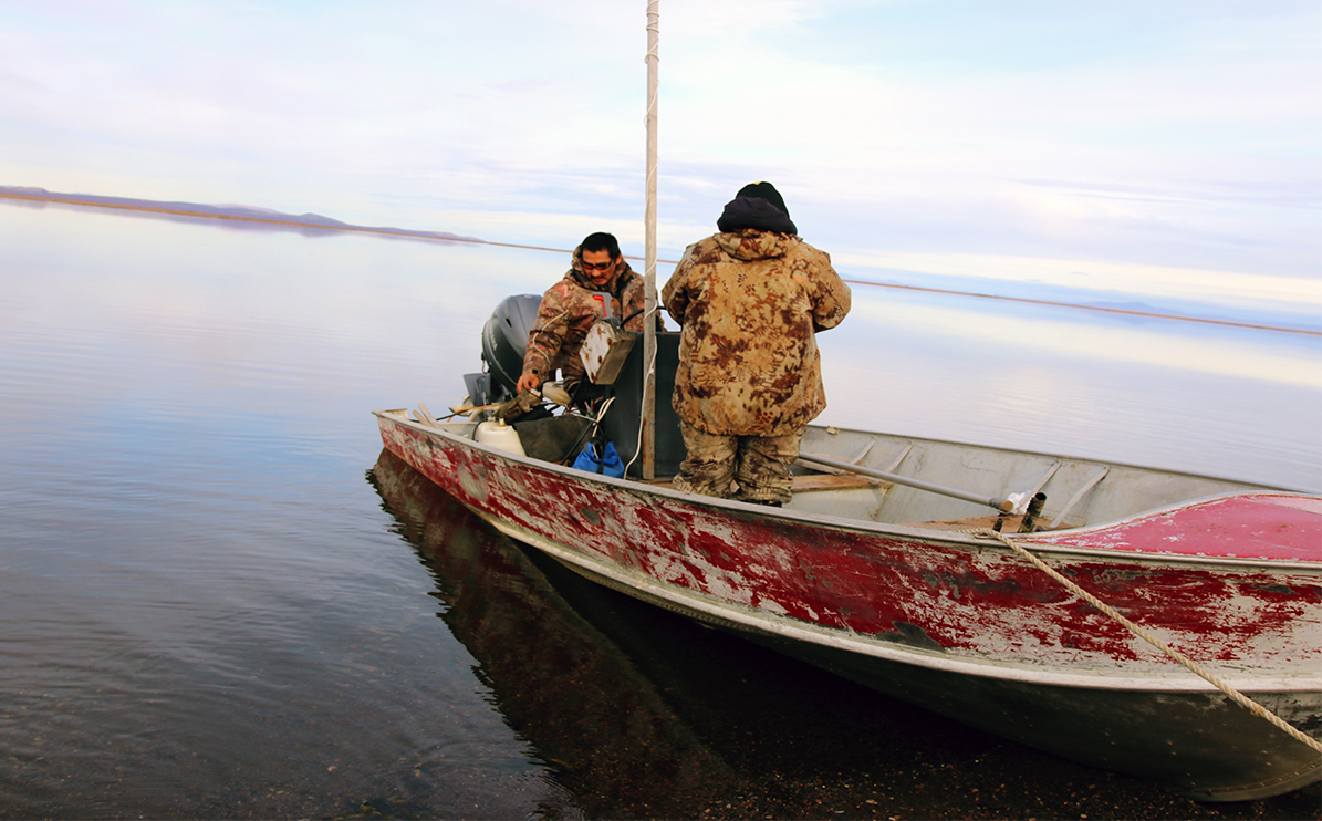
Reppi and Dolly preparing to cross the lagoon
There are few alternatives to living off the land and sea, and subsistence in the rural Arctic is survival embedded into spiritual and cultural dimensions.
“By the time my son is ready to take over, there might be no more ice, might be no more bowheads, because our ocean is changing,” Swan says, steering the boat into the river mouth. He describes how the sea ice is getting thinner each spring, and in the past few years, the lead, a narrow linear crack in the ice, has opened just half a mile from the beach. Bowhead whales migrate using the main current in the Chukchi Sea, miles away from the island, occasionally swimming through the leads for easier breathing.
“Back in the '90s, the ice was thick. We had to go 40 miles out to get to the open lead.”
Reading the rapidly changing landscape is becoming difficult even for the most perceptive hunters. The meanings of certain Inupiaq words describing the many forms of sea ice have become obsolete, no longer existing in the physical world.
“Black ice, uiñiq, signals of danger. Now the ice melts from the bottom up, and it doesn’t get dark. It just turns soft,” Swan explains from the helm.
Our journey through the coiling Kivalina River takes close to an hour. Signs of rapid riverbank erosion are evident along the way. Dolly points to a spot where a friend’s cabin fell into the water as the ground beneath it, distressed by thawing permafrost, collapsed.
“All that hard work of building a two-story cabin. . . . It floated down the next bend.”
We arrive at a narrow shore at the base of a steep hill and tie the boat up around an arctic willow. Climbing up the rise, we slide on clay and stone. On the top, covered with lichen and moss, Swan scans the distance between the hill and the illusively infinite, rolling tundra below for caribou.
“There should be a herd of 20,000 out there right now. There’s not as many as there used to be,” Swan says. “The Red Dog Mine’s landing strip cuts right through their migration route.”
He points to a small group of pale white specks moving north. Nearly invisible to the untrained eye, the caribou wander miles away. We choose to return to Kivalina, the herd migrating toward their winter-feeding grounds in the fading light.
A few miles east from here is the site of Kisimigiuqtuq, a hill assessed as a safe place for the village to relocate. An evacuation road that leads there from the shore is now being planned.
Don Antrobus, program manager of the Denali Commission, an agency that assists Alaska’s rural communities, says at this point in time completing the new village site within seven years is unlikely. In the United States, current disaster management policies primarily help people remain in existing settlements, and no formal relocation policy or national adaptation strategy exists.
The locals have uniformly opposed the idea of moving into cities, seeing it as the final blow to their traditional ways and cultural integrity. Despite living in fear and uncertainty, the people of Kivalina choose to hold on fast to what makes them who they are. “Our community belongs here,” Swan says as we descend down the mount.
The vast tundra around us, hued red from the last days of fall, is held together by permafrost. Made up of soil and rocks and frozen water, much of it is tens of thousands of years old, and now beginning to melt.
“Our climate is changing. We see it. It’s becoming really difficult, but we’re trying to adapt,” Swan says quietly, as he scouts the expanse for migrating caribou one last time, and we find balance in the small boat and depart back to the island.
 The Magazine of The Sierra Club

