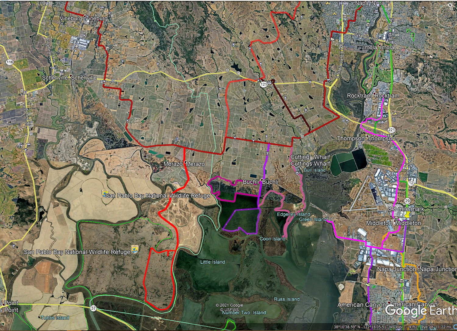
 In the last newsletter, I wrote about the benefits of having an electric bike. One of the main reasons for getting one is because you can go farther, faster and with less effort than a regular bike. Because of this, I have been able to go on 30-50 mile treks that I normally would have shunned, due to, well, being a lot older than I used to be. I would like to share a ride that can be done fairly easily with an e-bike, preferably with what they call either a hybrid bike, which I have (it can take both road and some off-road trails), or a mountain bike. Photo: aerial view of my bike routes in the Carneros. Photo: Satellite ariel view of my routes in the Carneros.
One of my favorite rides has been to explore the Carneros area, which is in Southwest Napa County. I've been finding great back roads and rideable levies, which not only take you through world famous Chardonnay and Pinot Noir vineyards, but also into the beautiful marshlands of the Napa Sonoma Marshes Wildlife Area and a portion of the San Pablo Bay National Wildlife Refuge. I'll describe one loop trek, which I like to take in a clockwise direction, starting in Napa. The total distance is roughly 30 miles, which I've completed in about 4 hours.
Wherever you are in Napa, make your way to Foster Road. That will be our starting point. Head South on Foster, noticing the area on your left when you pass Snow Elementary School. This is the Ghisletta and Horseman’s Ranch properties, a 144-acre area that the City of Napa has almost entirely annexed and has earmarked for a “multi-use development” zone. The possible development of the area is very controversial because of the many environmental and safety issues that exist.
 As you reach the end of Foster, make your way to Stanly Lane (being careful crossing the highway). This becomes part of the San Francisco Bay Trail, a system of trails for bikes and pedestrians that will, when completed, span some 350 miles around the entire Bay.
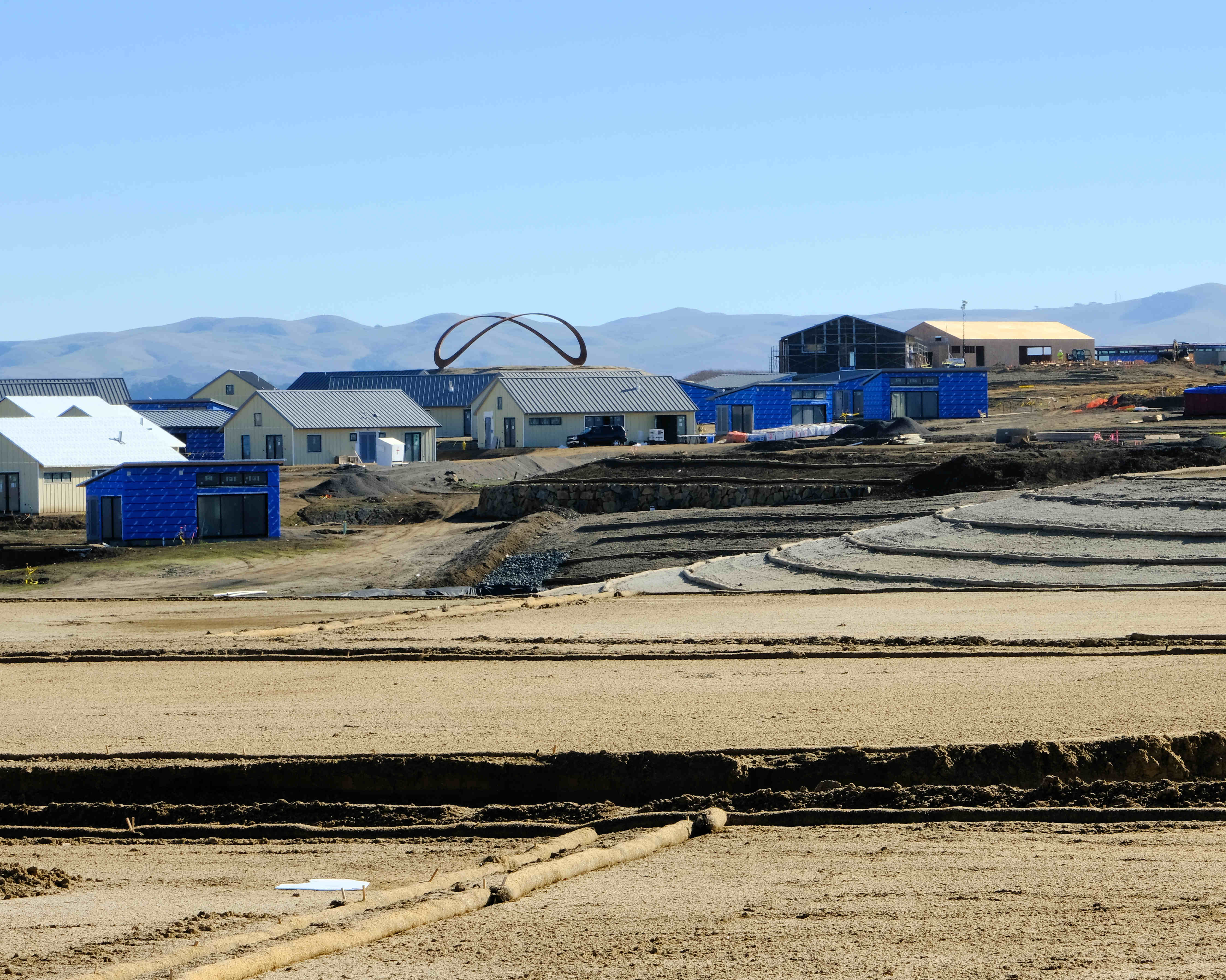
You'll head around the new Stanly Ranch Resort development, which has the Gordon Huether Infinity sculpture as its focal point. This is another huge development from the Auberge Resort Collection. We're now at Stanly Crossroads. Instead of circling around the resort, you could continue to the end of Stanley Ln., past the Starmont Winery, and circle around some vineyards to your right, with the Napa River watershed to your left. This route is a dirt road and is a little awkward because you ride through some private property. In any case, you'll eventually get on Las Amigas Rd., heading West.
Continue past Cuttings Wharf Rd., and wrap around Las Amigas until you get to Milton Rd. Continue straight onto Milton, eventually passing the Napa Valley Marina on your left. The Marina, which has been around since 1957, not only has a deli, but could be the place where you buy your next yacht.
 When you get to the railroad tracks, stop to observe the train bridge to your left. I used to think it was a draw bridge, but actually, when a train wants to cross the Napa River, the tracks, which are suspended from above the bridge, are lowered down over the river. After the train passes over the river, the tracks rise again.
Now go all the way to the end of Milton, admiring the various homes that line the Napa River. The expected sea level rise from climate change with resulting flooding of the area is a long-term issue. Residents are still trying to figure out what kind of projects are available to help mitigate potential disaster.
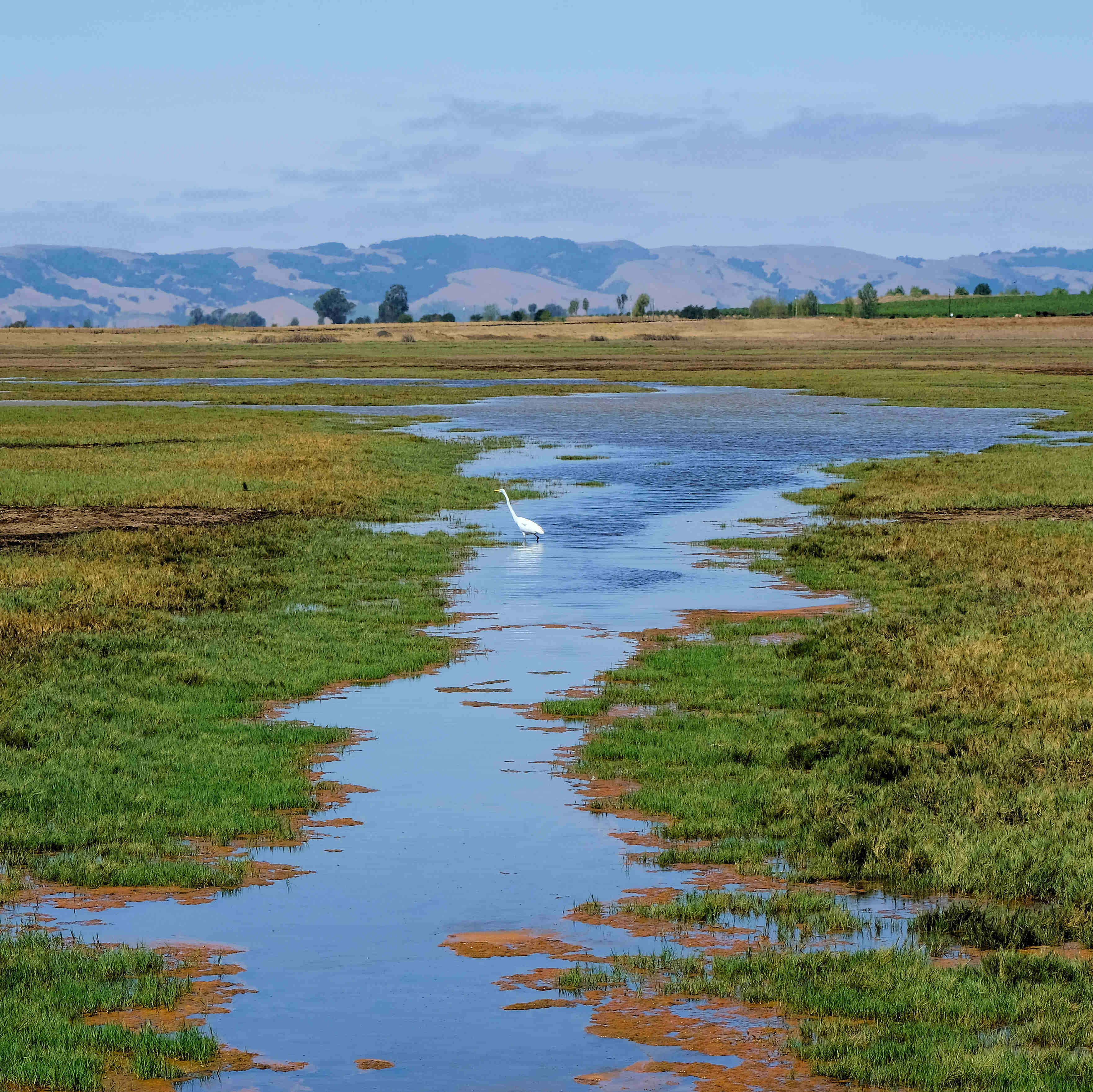
At the end of Milton, there is a dirt trail that takes you back in a northerly direction, along a very large pond. The dirt trail, which hugs on top of a levee, is fairly well hardened, and isn't very bumpy; it seems to be in constant use by the locals who walk along it. As you begin to wrap along the pond heading West, you'll see a multitude of birds. According to the California Department of Fish and Wildlife, you might see the Black-Crowned Night Heron, Killdeer, American Bittern as well as the secretive Clapper Rail. Double-Crested Cormorant are frequently seen here as are Great Blue Heron. You'll also see Great Egrets, Red-tailed hawks, and Bufflehead ducks. This entire area is home to over one hundred twenty species of birds.
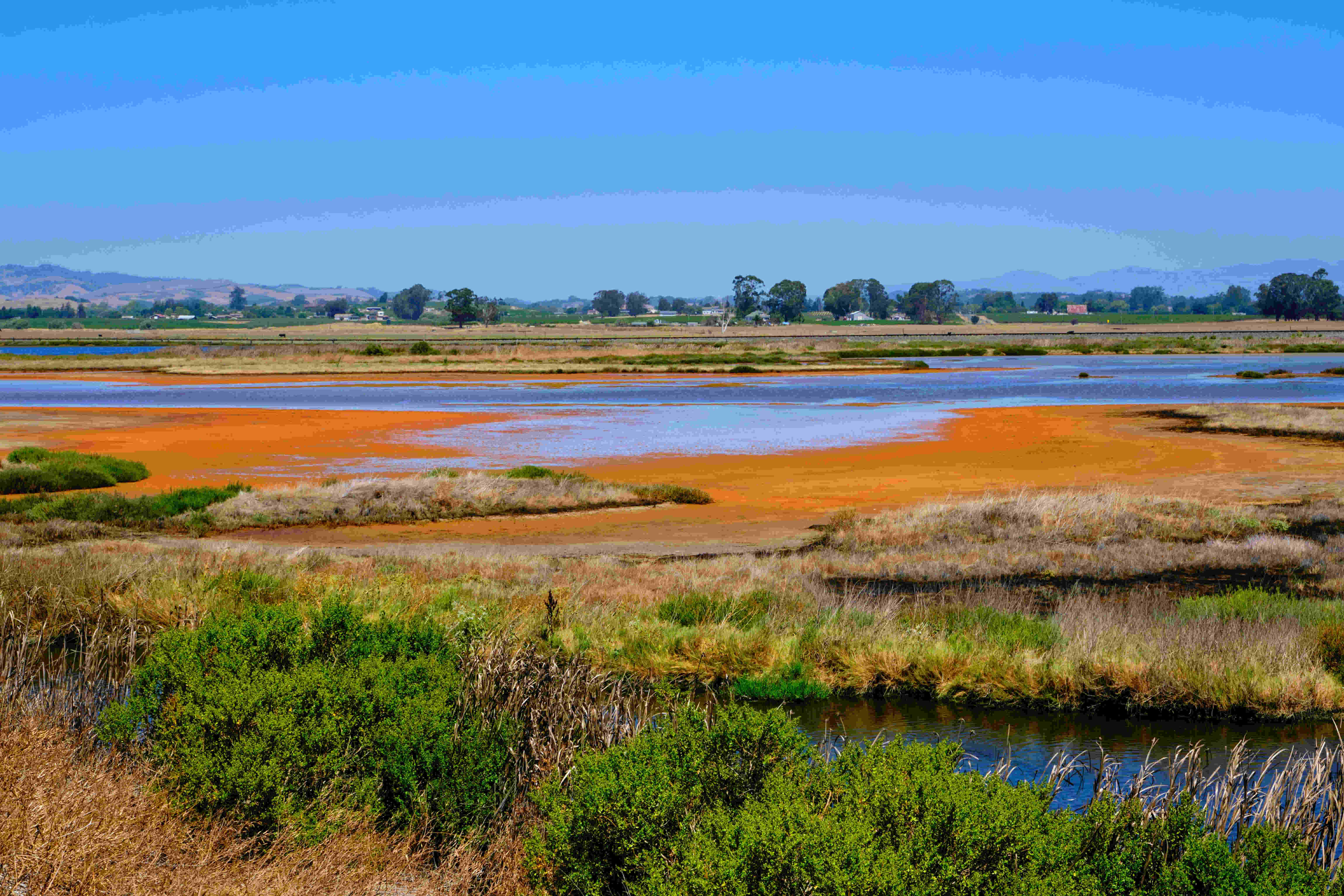 You will then come to what appears to be the end of the levee, but you can still continue along it, first heading in a northerly direction, and then wrapping around heading back westerly. This is one of my favorite spots for stopping and bird-watching, or observing the different colors of the water and mud. I found this route first by looking at it from Google Earth on my computer. I didn't know whether it was passable until I actually rode on it. Although this levee was a little grassy and bumpy in spots, it was certainly passable.
You eventually do come to a locked gate, which is passable to your right. Keep going South and you will end up in Buchli Station Park, an area that the California Department of Fish and Game has been trying to convert back to its original habitat after decades of farming and being used as a system of evaporation ponds for the salt industry (more info about it here).
Once I'm on the main levee of the park, I like to circle around the beautiful lake-like pond clockwise, going back to the parking lot via the levee in the middle of the pond. From Spring until Fall you cannot traverse that levee because it is a nesting area for migratory birds. I've explored other areas of the park, but the routes are a bit too complicated to describe.
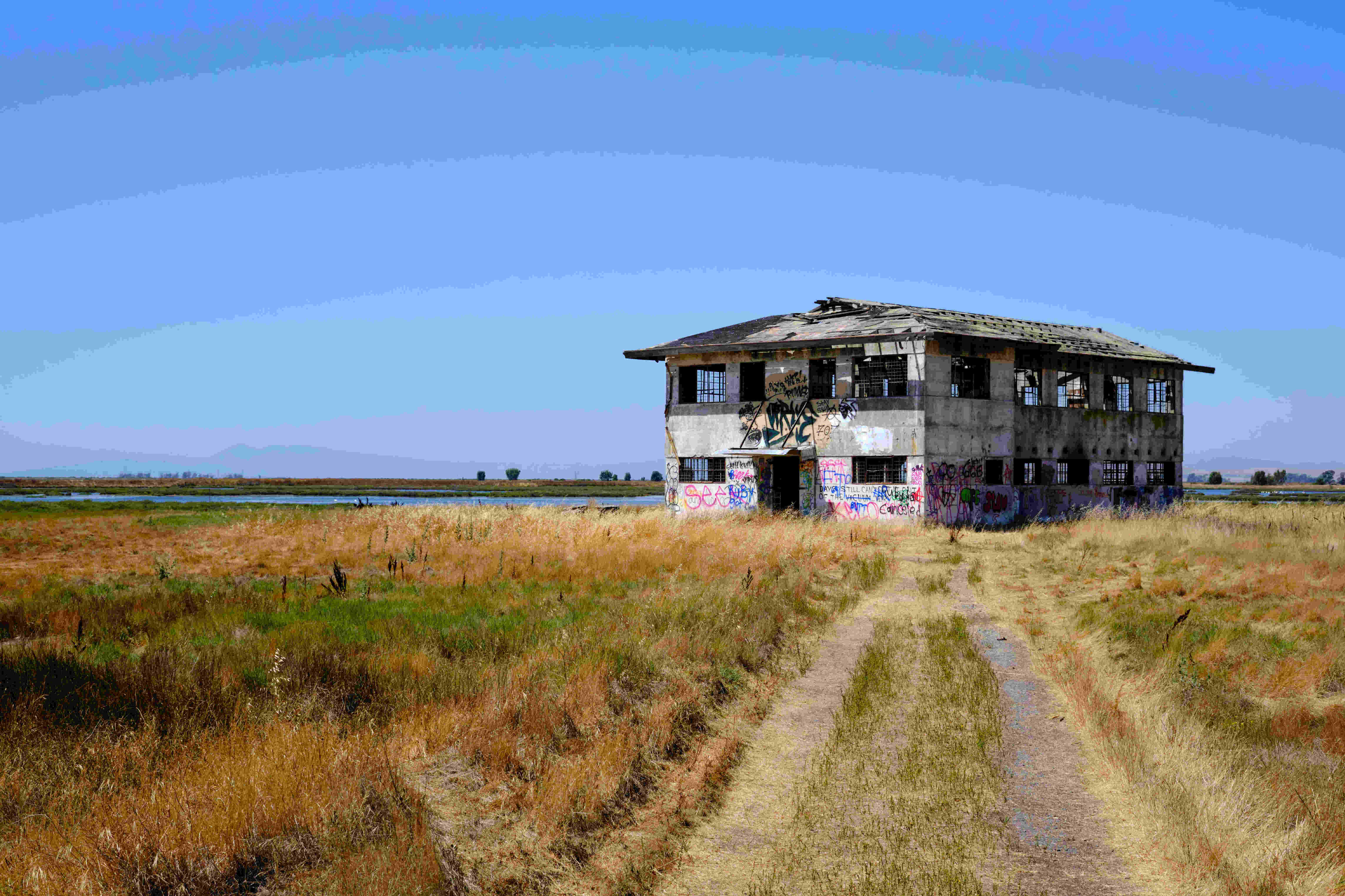 Don't forget to stop by the abandoned Press Wireless structure, which used to house radio receiving devices that received transmissions of news reports from all over the world. In 1957, it was the first station in the western US to pick up signals from the Soviet Sputnik, the world's first satellite.
As you leave the park from the parking lot, continue North on Buchli Rd., which is a dirt road for about a quarter mile. Maybe you might want to stop in at Bouchaine Winery for a wine tasting, but do keep in mind you're only a little over halfway into your trek.
There are a couple ways to continue. If you're a little tired, you can head East on Las Amigas and either turn left on Cuttings Wharf Rd, and head North towards the Carneros Inn via Los Carneros Ave, or go home the way you came. If you have an ebike, then you are probably not tired yet, so head West on Las Amigas until its end, turning right on Duhig Rd. This takes you all the way to the highway, where you turn right, staying on it for only about a quarter mile before turning left onto Old Sonoma Rd. Then take a quick left onto Dealy Ln.
 At this point, the way in which I head back into town is via a right onto Henry Rd, left onto Buhman Ave., right onto Congress Valley, and a left on Thompson Ave. I prefer these less-traveled, beautiful back roads to the much busier and less safe Old Sonoma Rd. At this point you'll find yourself on Browns Valley Rd, which although busy, is fairly biker friendly. From there you know where you're heading on your way home. When home, be sure to stretch, because heck, you've gone about 30 miles. Then have your much deserved glass of wine.
Do you have a favorite ride to share? Please tell me about it at napavalleysierraclub@gmail.com. Happy Trails. Thank you, Nick Cheranich