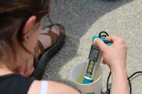
Attention all Water Sentinels! Now that spring is here, most of you will be headed out to the stream to take samples. We have a few helpful tips to make your testing successful.

1. You will need to calibrate your meter. Most likely, it has not been used for a few months, take an extra few minutes to calibrate the meter to ensure accurate testing.
2. Did you forget how to calibrate your meter? We have a great video with step-by-step instructions. The video will also show you how to change modes (in case you forgot).
3. DO NOT leave your meter and test strips in your car. Heat can damage the meter and strips, please store in a cool, dry space.
4. Need more data sheets? They can easily be found on the Water Sentinel Resource Page, under 'Surface Water Reporting Form'.
5. Please double check your latitude and longitude coordinates. We use a mapping software to map our data and it is imperative the coordinates are correct.
Instructions for determing latitude and longitude:
A. Latitude and longitude should be in decimals, NOT minutes.
B. Latitude is postive, longitude is negative.
C. Latitude should be close to 41.0000
D. Longitude should be close to -81.0000
E. If you need help determining your coordinates, you can use this website to drop a pin on your site location: www.latlong.net/
6. Please double check your units before submitting data.
Instructions for sumbitting data:
A. Make sure TDS and Salinity is recorded in parts per million (ppm). We have seen some data reported in parts per trillion (ppt), please do not use this unit, this skews the data and takes time to fix.
B. Report time in 24 hour format.
C. Report temperature in Celcius.
If you use these helpful tips, it will be easier for us to sort the data and update the water sentinel maps in a timely fashion. If you need further assistance, please email us at: cleanwatersierraclub@gmail.com