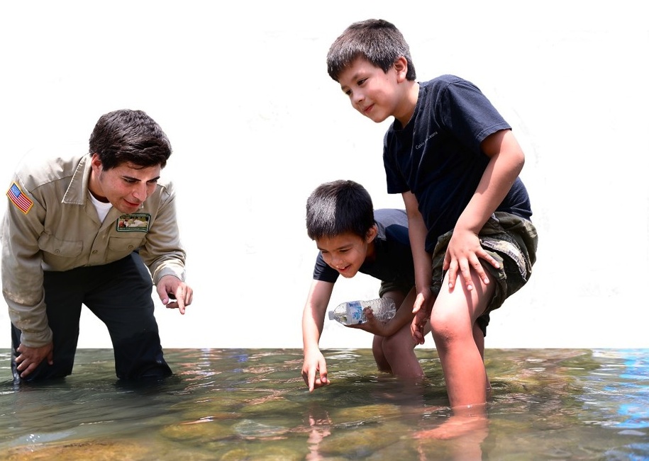
Those who visit the San Gabriel River north of Azusa find few clean restrooms or trash cans, few places to safely access the river, few interpretive programs and few rangers (especially multilingual ones) to answer questions about the area. Water quality has been degraded by trash and aquatic life threatened by human-built dams and mechanical dredging for gold.
But it doesn't have to be this way.
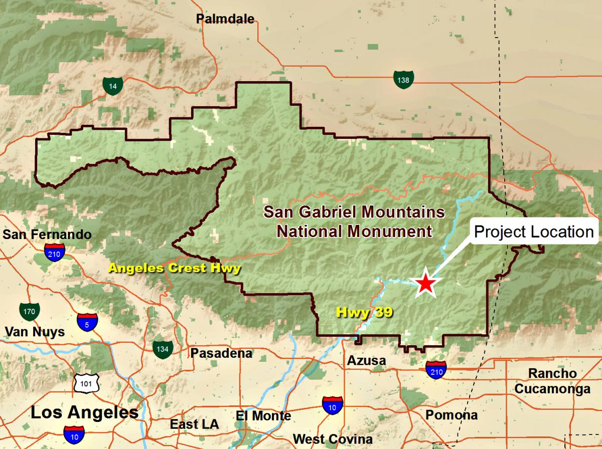
The good news is that the recently-launched East Fork Project will improve conditions along a 2.5-mile section of the San Gabriel River, upgrading the visitor experience for all. It's a joint venture of the Watershed Conservation Authority (WCA) and the U.S. Forest Service, the agency that manages the San Gabriel Mountains National Monument.
 “I think the East Fork Project begins to fulfill the vision the president had when he established the monument in October 2014,” said watershed authority manager Rob Romanek. If all goes as scheduled, the estimated $10 million to $15 million project could be completed as early as 2019. Funding is expected from the Rivers and Mountains Conservancy and other agencies, according to Romanek.
Upgrade the recreational experience
The project is designed to promote stewardship, enhance recreational quality and restore the river ecosystem. Planning is underway, funded by $250,000 in federal funds dedicated to the monument. The project’s scope includes the last two miles of the East Fork Road, roughly from Camp Williams to the East Fork parking lot plus an additional half mile down into Heaton Flat, gateway to the Sheep Mountain Wilderness and the Bridge to Nowhere.
The watershed authority and the Forest Service will be soliciting public comment in June on project plans, officially known as the proposed action, as part of project’s official environmental review. Two public meetings are in the works for the San Gabriel Valley, and a schedule will be released in May.
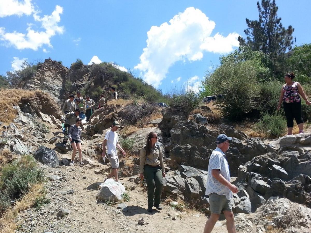
| Hiking trails in the area of the East Fork of the San Gabriel River. |
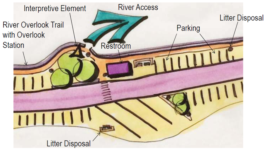
A core principle of the East Fork Project is the sustainable access model. It was developed for the watershed authority by Blue-Green Consulting, an environmental design firm, after they reviewed best practices at national parks and national monuments. The conceptual design for the project includes informational kiosks to provide visitors with educational and interpretive materials (see rendering at right).
Creating a new access trail
Redesigned visitor parking and new transit stops will be concentrated near six well-designed river access points that will channel visitors to multilingual interpretive signs, restrooms, trash receptacles and river overlooks. Access points will be connected by a new 1.5-mile East Fork Scenic Trail above the river along the East Fork Road. All user-created access points will be blocked. Construction will be accomplished off-season to reduce the impact on visitors during the popular summer months.
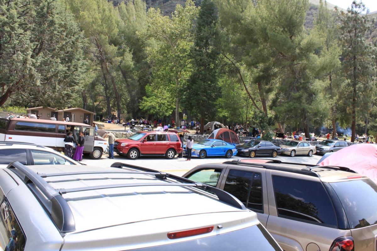
| A busy weekend at Oaks Picnic Area, East Ford of the San Gabriel River. |
The project also addresses issues of diversity and inclusion. Ninety-three percent of visitors to the river itself are Latino, many in family groups escaping the heat and enjoying the shady river setting. The watershed authority's commissioned research shows that many come from park-poor communities. Some of these users might disperse into upper canyon areas such as Heaton Flat if there were better display maps of recreational opportunities.
Current upper canyon users – generally those who park at the East Fork parking lot – are more likely to be hikers.
After compiling the data from user surveys conducted in 2013-15, the watershed authority began the work of figuring out how to improve the visitor experience. Preliminary designs were developed with the help of Blue-Green Consulting. All designs intend to educate visitors and reduce trash and human waste entering the San Gabriel River and to limit construction of user-created dams, which are hazardous to the endangered Santa Ana sucker fish and other aquatic life.
Site-specific improvements are also in the works.
Picnic area makeover
The Oaks Picnic Area will be redesigned to improve traffic flow with more grills, larger tables, and more bear-proof trash receptacles. Non-native trees will be replaced with sycamores and oaks. An interpretive botanical loop trail is under consideration that would be suitable for kids.
The current East Fork Parking area will become a shaded interpretive center, picnic area and river overlook with parking moved to the to the abandoned East Fork Station parking lot to the east. The Sierra Club has suggested that the interpretive center emphasize wilderness education and the “leave-no-trace” ethic. The addition of a 2-mile loop trail heading up to the high country above the Cattle Canyon confluence will provide a dramatic overlook of the entire East Fork area and views of Mt. Baldy and the San Antonio Ridge.
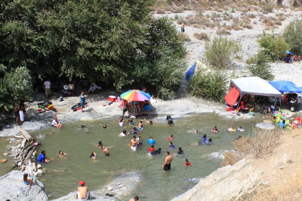
| Visitors play in the San Gabriel River on a busy summer weekend. |
“This is a truly visionary project,” said Hop Hopkins, Sierra Club Senior Organizing Manager for California. "We are very pleased that transit and shuttle stops are part of the design. However, the current plan might reduce overall parking before permanent transit solutions are in place. This concerns us.”
The Sierra Club and other groups are working to obtain funding for transit to trails programs, such as routes from the Gold Line station in Azusa, that would ultimately reduce vehicular traffic along often clogged access roads leading to the San Gabriel River. In the immediate future the Forest Service plans to hire 10 field rangers in the late spring to work through the summer assisting people to better understanding recreational opportunities and practice environmental stewardship. The hiring is being done under a cooperative agreement with the San Gabriel Valley Conservation Corp.
The East Fork Project (bearing the official name of “San Gabriel River Cattle Canyon Improvement Project”) is part of a larger master agreement signed last year between watershed authority and the Forest Service that could include projects that extend beyond East Fork, including other heavily used sections of the San Gabriel River in the national monument and the San Gabriel River watershed.
John Monsen is a consultant to Sierra Club National Field Staff in Los Angeles for San Gabriel Mountains Forever and he serves as Co-Chair of the Sierra Club Angeles Chapter’s Forest Committee. He was a member of the Sierra Club’s National Field Staff in Los Angeles for seven years where he worked on public lands and environmental justice issues. He represents the Sierra Club on the East Fork Project Stakeholders Advisory Committee.