Can Street Art Get San Franciscans to Take Drought Seriously?
Artist Emily Schlickman reveals the city's forgotten waterways in San Francisco's Market Street Prototyping Festival
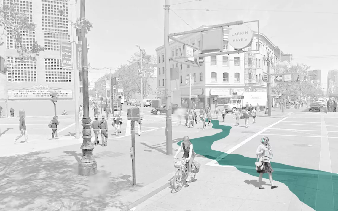
Image courtesy of Emily Schlickman
As San Francisco emerges from its so-called wet season, residents might be surprised to learn that the city was once covered in waterways, because, in case you haven't heard, it’s been drier than Donald Trump’s withered combover out here.
But the waterways exist even today. Market Street—the main artery in San Francisco—passes above the now culverted Hayes Creek, which feeds into the bay (and occasionally floods BART tracks). When the area was still covered in 80-foot-tall sand dunes, the ephemeral creek meandered underground and only surfaced after big storms.
Out of sight, out of mind? Not for long. Landscape architect Emily Schlickman will draw attention to the forgotten waterway during the Market Street Prototyping Festival from April 9 to 11. The festival, in conjunction with the San Francisco Planning Department, is poised to make Market Street more pedestrian-friendly by dressing it up with interactive art installations. All designs are crowdsourced, and community favorites will become permanent.
Schlickman will use biodegradable chalk to outline on the ground the subterranean marsh portion of Hayes Creek that flows near Civic Center (see map below). If the installation morphs into a longterm project, she plans on re-tracing as needed. “I’d love to tie it into actual water cycles and have it change over the course of a year.”
Schlickman believes her project, called Ghost Arroyos, will surprise festivalgoers: “Most residents have no idea this creek exists, even though it supplies the fountain in the United Nations Plaza.” She goes on to compare the creek to California’s reservoirs, which also rely on heavy rainfall. “Storms basically sustain this state, and I think Ghost Arroyos will show how precious rainwater is here.”
We could use the reminder, considering how lackadaisical our response has been to the worst drought in 1,200 years. Heck, California just started to impose mandatory water restrictions last week (and we were conspicuously easy on oil and agriculture, which consume 80 percent of the Golden State’s water).
Ghost Arroyos isn’t the festival’s only installation focusing on water resources in California: the Exploratorium is working with paleoclimate scientists Daniel Griffin and Kevin J. Anchukaitis to create Tree Sitting, which will display renderings of tree ring samples to show the severity of the current drought. “Trees have quietly been collecting data for us,” the project description notes. “They’ve been tracking rainfall and temperature for thousands of years.”
Tree ring width often correlates with water supply. If there’s lots of water, the tree will grow and produce a wide ring. If there’s not a lot of water, that tree will grow less, producing a narrower ring. When a tree has multiple narrow rings in a row, it’s indicative of a drought period. Tree Sitting will portray our current drought—a lot of narrow rings—as the worst on record by comparing it to previous periods of multi-year drought in California.
“We want Tree Sitting to be a platform for conversation [about drought],” says Adam Green, a Project Lead at the Exploratorium. And with a primo spot in the Civic Center district, it should be.
While the tree ring installation hangs nearby, Schlickman’s creek will flow between the largest governmental institutions in the city, and—if all goes well—trickle into the minds of the decision-makers inside.

A map of the Civic Center district in the Market Street Prototype Festival, where Ghost Arroyos will be featured. | Image courtesy of Emily Schlickman